Can I Ditch My DSLR For My Cellphone Camera?

The big arroyo bubbles past the high sierra trail, Sequoia National Park

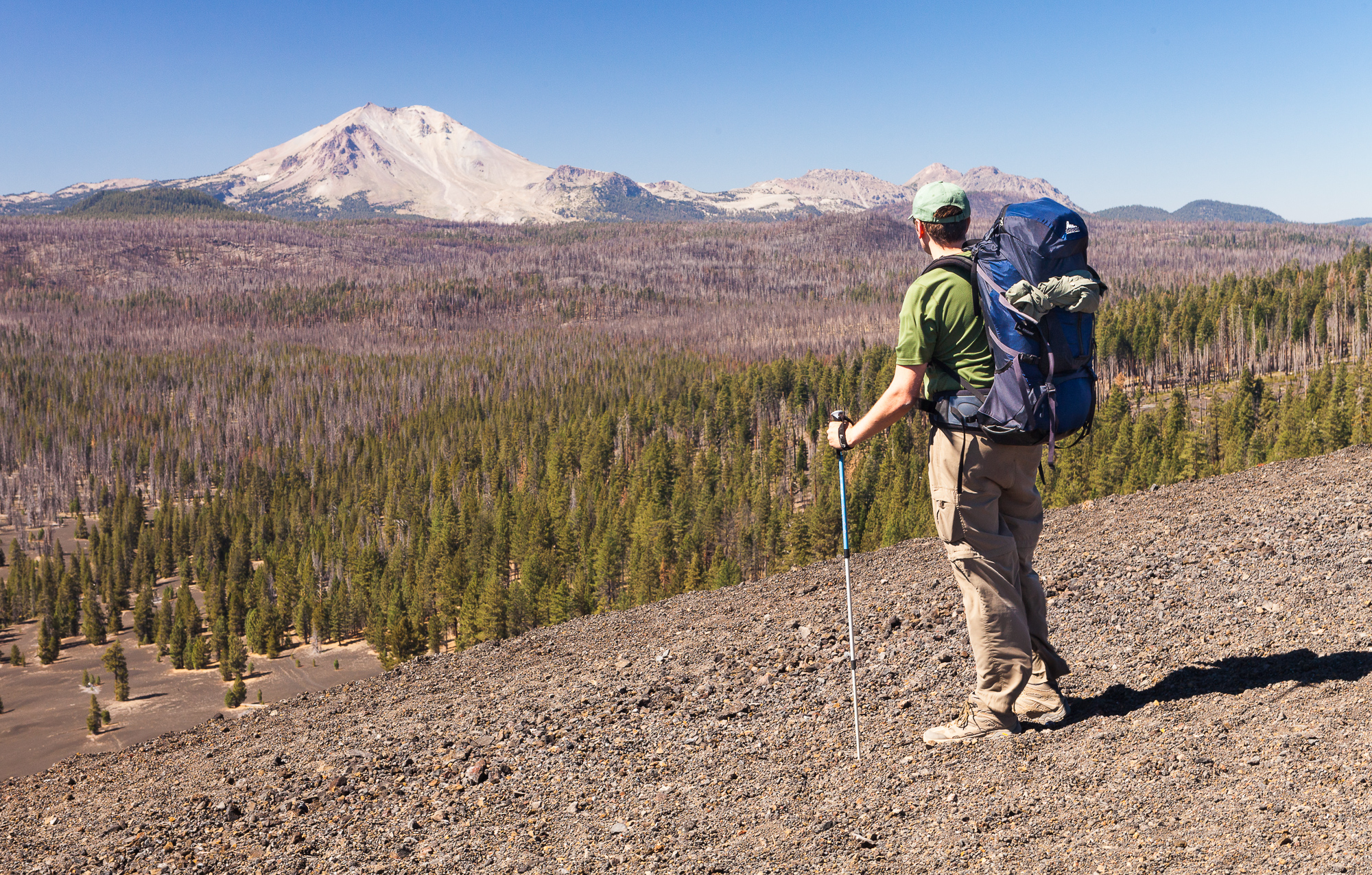
Last year I finally purchased a phone with a camera good enough to take photos I was more or less happy with. So on a backpacking trip late last summer, I decided to put my new phone to the test and pit it against my bulky DSLR and associated gear that I lug along with me on my trips.

First of all, for those who haven’t backpacked before, the best preparation you can make for your trips is to shed as much carry weight as possible. This means light weight backpack, sleeping gear, etc in order to be able to hike further each day and in more comfort. I spend days weighing my gear and making tough decisions about which comfort items to leave behind. That’s why it is so painful when I add up the nearly 9 pounds of extra weight for my camera gear.

For multiday backpacking trips, I typically take the following items:

  • camera body (including l-bracket)
  • 24-70mm f/2.8 lens
  • light weight tripod and small ball head
  • cotton carrier vest (this way I can carry the camera on my chest for easy access along the trail)
  • extra bracket to attach camera to vest
  • at least 1 extra battery
Two boulders stand sentinel over a valley catching the last rays of daylight, Sequoia National Park

Because of all this extra weight, I’ve been looking for something lighter weight that could deliver equal or almost equal results as the DSLR. Enter the ultimate multi-use device, the cell phone. A couple of years ago my stand-alone Garmin GPS stopped coming with me on trips (I can navigate perfectly well with pre-downloaded maps and my phone’s GPS), and this time I was testing the new cell phone’s camera to see how it would stack up to my pro gear. I wasn’t expecting parody of features or quality, but if it was “good enough” it would save me about 9 lbs of gear – an incredible amount of weight for backpacking.

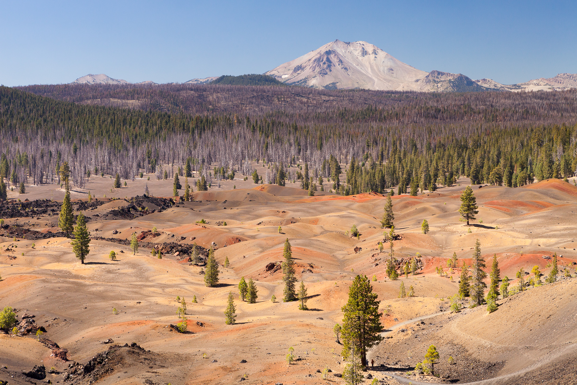
As I often do, I set out with my friend Steve to explore a new area of the Sierra Nevada over the next five days. Our destination was Sequoia National Park, departing from the remote Mineral King ranger station. We would be hiking in to intersect part of the High Sierra Trail (becoming much more popular over the last few years as the JMT has been at capacity all summer).

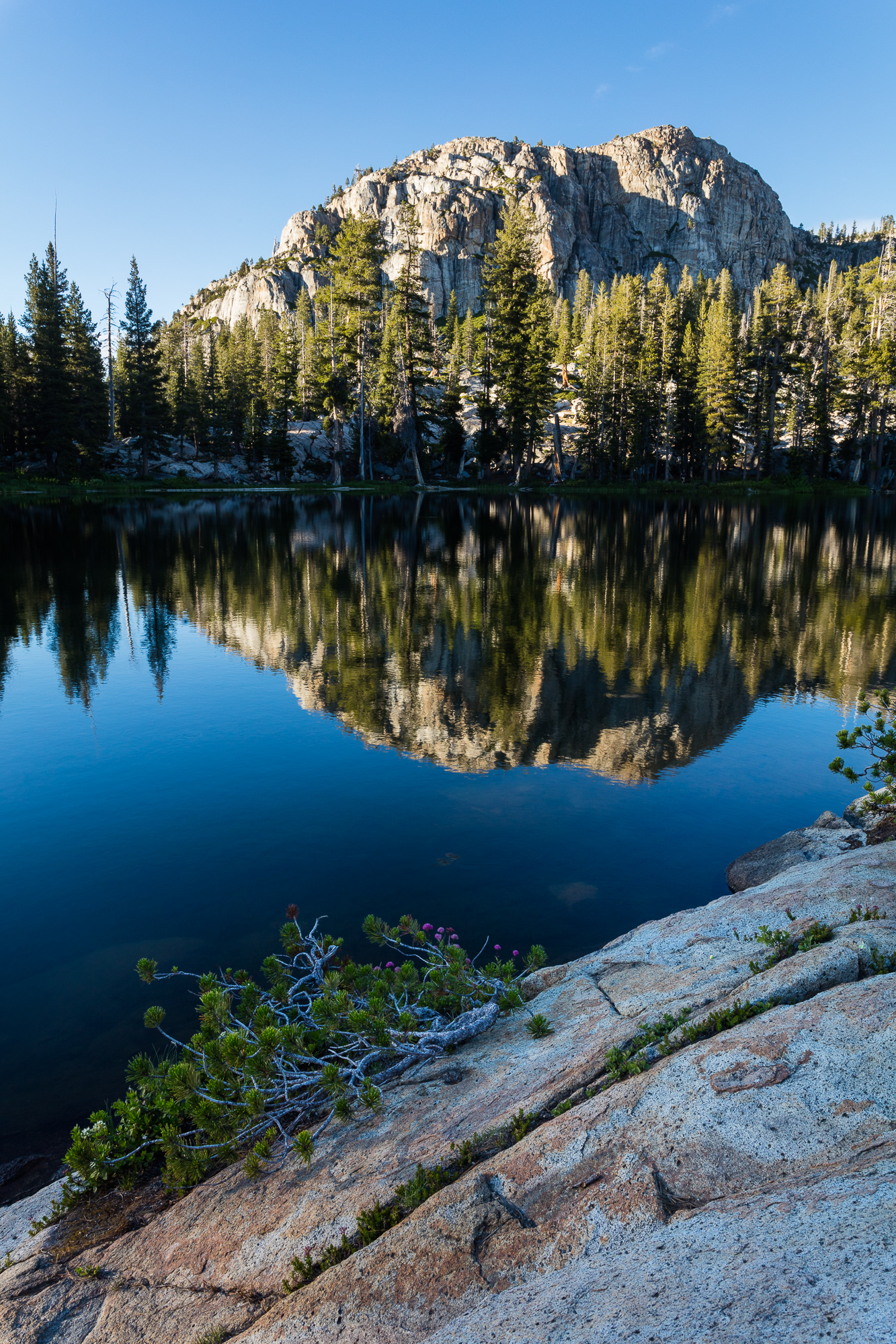
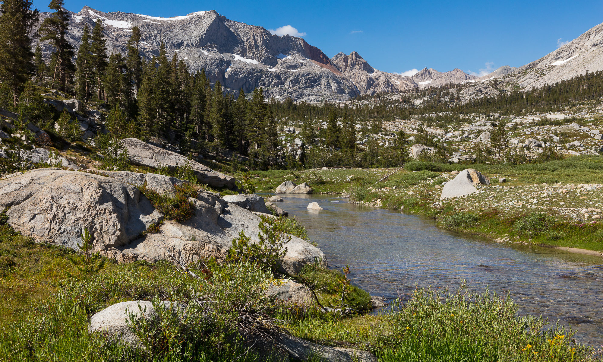
The photo above was taken with my Google Pixel, sporting one of the better cellphone cameras on the market (at the time). This was taken from our first camp at sunset, past Timber Gap. Although the phone shoots RAW, I’ve uploaded the JPG that was processed in-camera to give you an idea of automatic results. To be honest, I wasn’t able to pull much more out the photo through post-processing the RAW file – it appears as though Google’s processing algorithms do a very good job here.

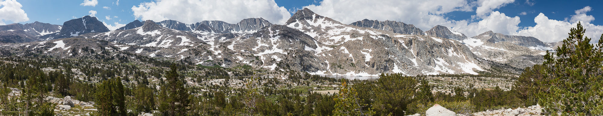
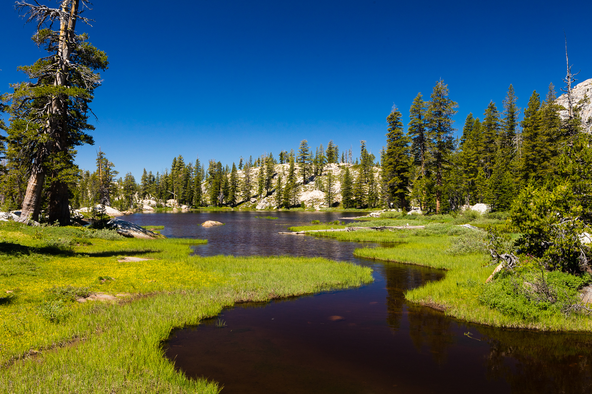
On our second day, we got a very early start, and climbed to the Great Western Divide by 10 in the morning. We quickly dropped down into the next valley, and intersected with the High Sierra Trail. Our destination was further north, nestled at the top of a valley adjacent to several off-trail lakes. Neither of us had been here, but the area looked great for camping and photography based on topo maps.

One of the first things we noticed as we met the High Sierra Trail on this warm August afternoon was a relative lack of people. This was a great sign, as we enjoy the solitude of the wilderness. One of the biggest disappointments in backpacking is to struggle along a trail for hours, only to come to a spot overrun by a loud group. We attributed the scarcity of hikers to the fact that there had recently been a complete washout further up the High Sierra Trial. This caused people to either turn around to go back the way they had come, or to cancel their trips altogether. As we were not through-hiking the trail, it didn’t affect our trip at all. But we got to benefit from this temporary closure.

Wildflowers bloom just outside of nine lakes basin, with M. Lippincott in the distance, Sequoia National Park
Wildflowers bloom in the late summer, Sequoia National Park

Our long day ended in a beautiful campsite overlooking the valley we had hiked up. It was difficult to find a good spot to set up tents, but after careful searching we found a prime location. As the sun got lower in the sky, we realized that we likely had the entire valley to ourselves, as we hadn’t seen another soul for hours, and the few campsites closer to the trail were deserted.

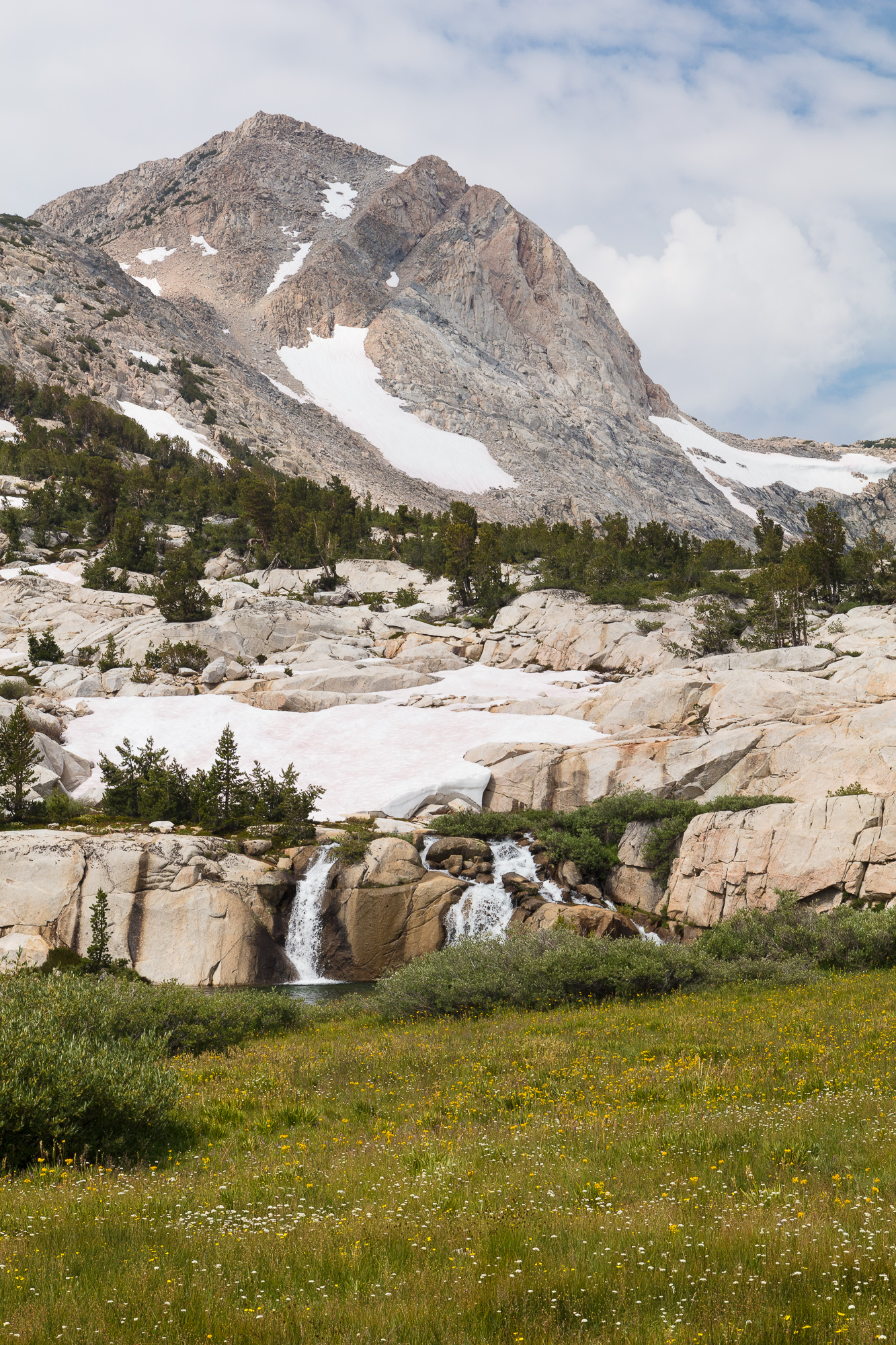
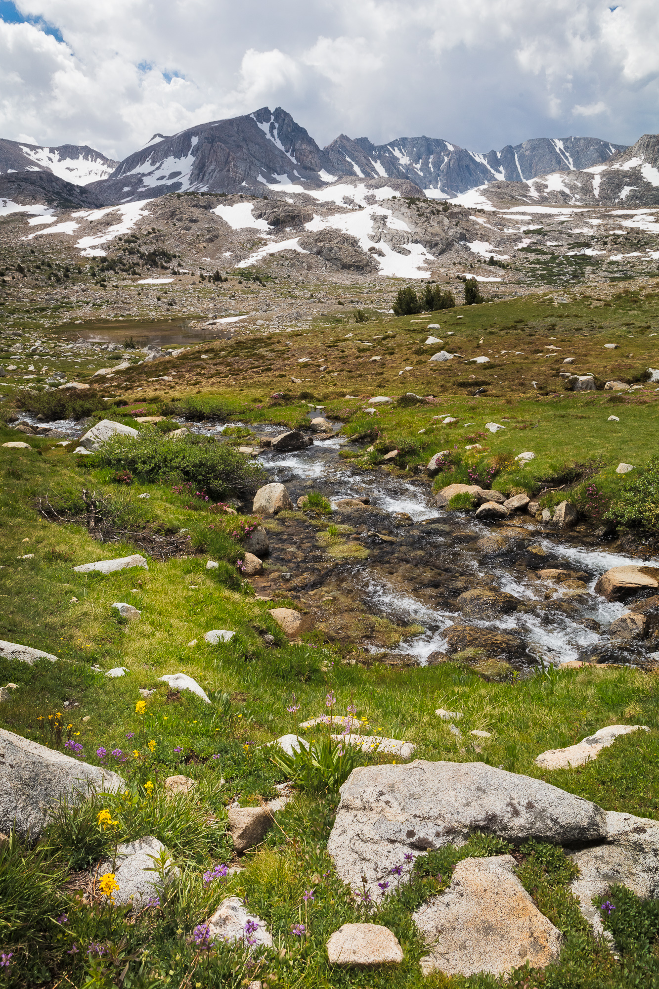
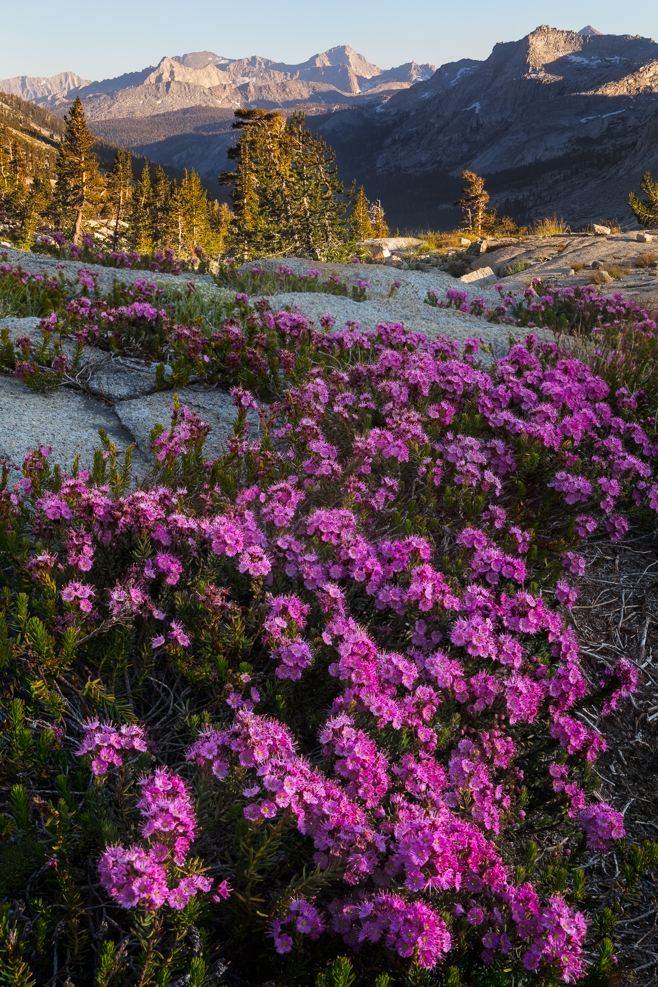
In addition to the glorious solitude, we were treated to a variety of wildflower blooms all around our camp. Even though it was already August, these flowers were in peak bloom as we were well above 11,000 feet. The photo above was focus stacked with my 50 MP Canon 5DSr. Although I took the same photo with my phone’s camera, it really couldn’t achieve the quality of the DSLR. Being able to focus stack with my DSLR gave me crisp detail throughout the entire scene, whereas the cell phone couldn’t hold that deep focus. In addition, once you zoomed in beyond regular computer screen size, the detail of the phone camera started to fall away and more digital artifacts and noise were introduced. This would affect the printability of the image, and ended up being something I just couldn’t sacrifice, even if it meant carrying an additional 9 lbs of gear.

Iceberg Lake remains cold year round, showcasing chunks of ice that float from one shore to another, Sequoia National Park
Many mountain lakes remain cold year round, showcasing chunks of ice that float from one shore to another, Sequoia National Park

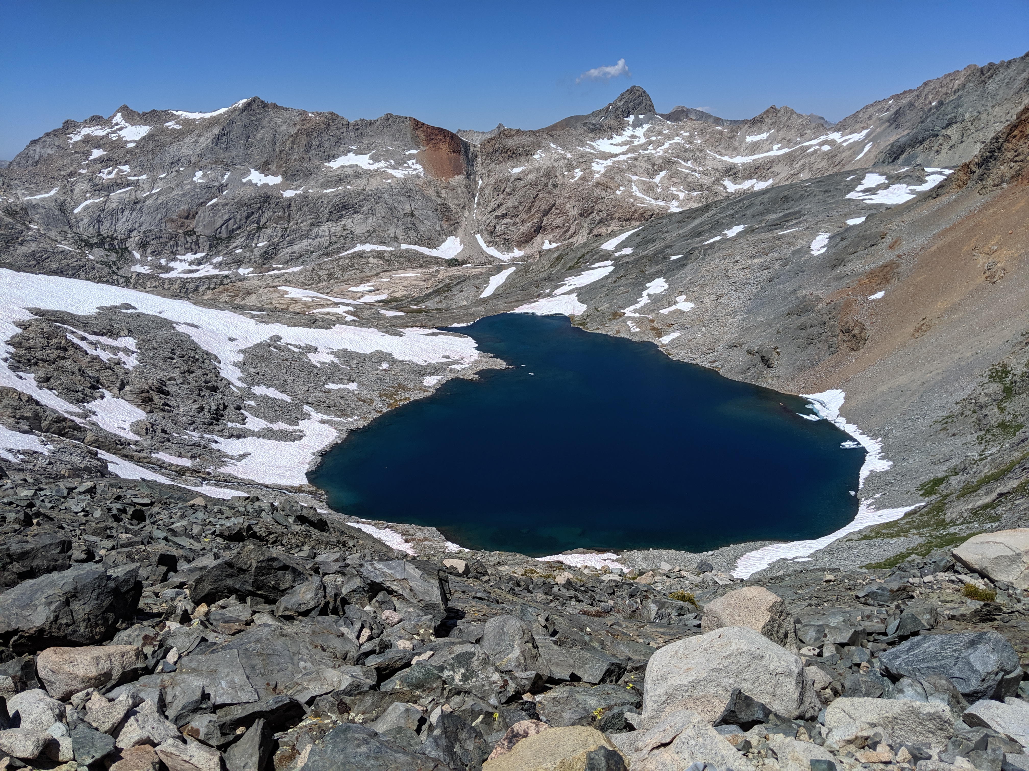
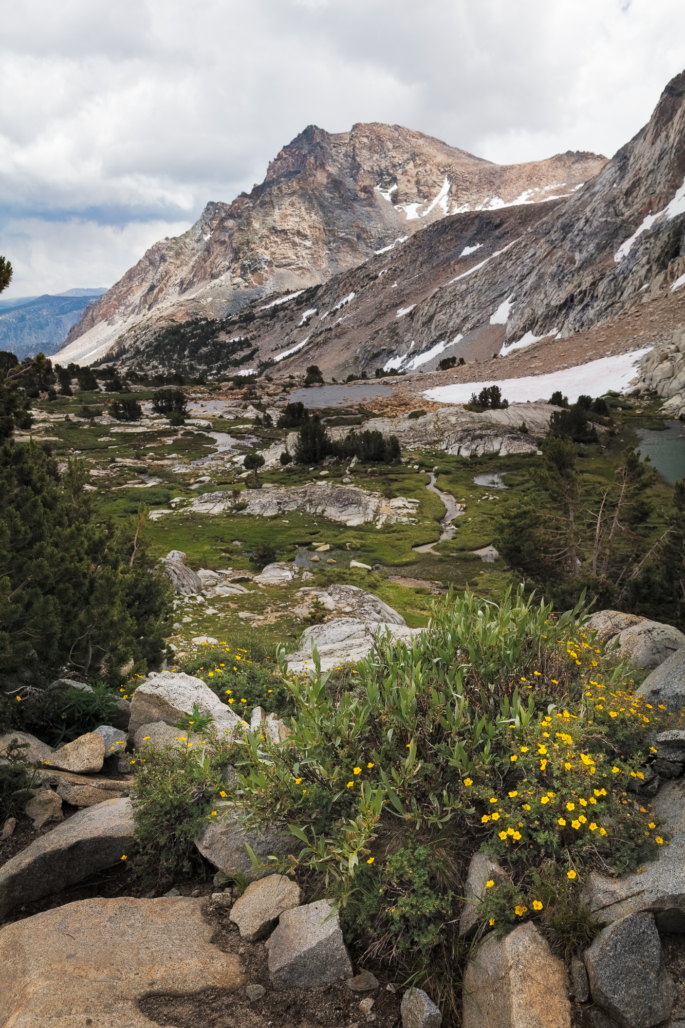
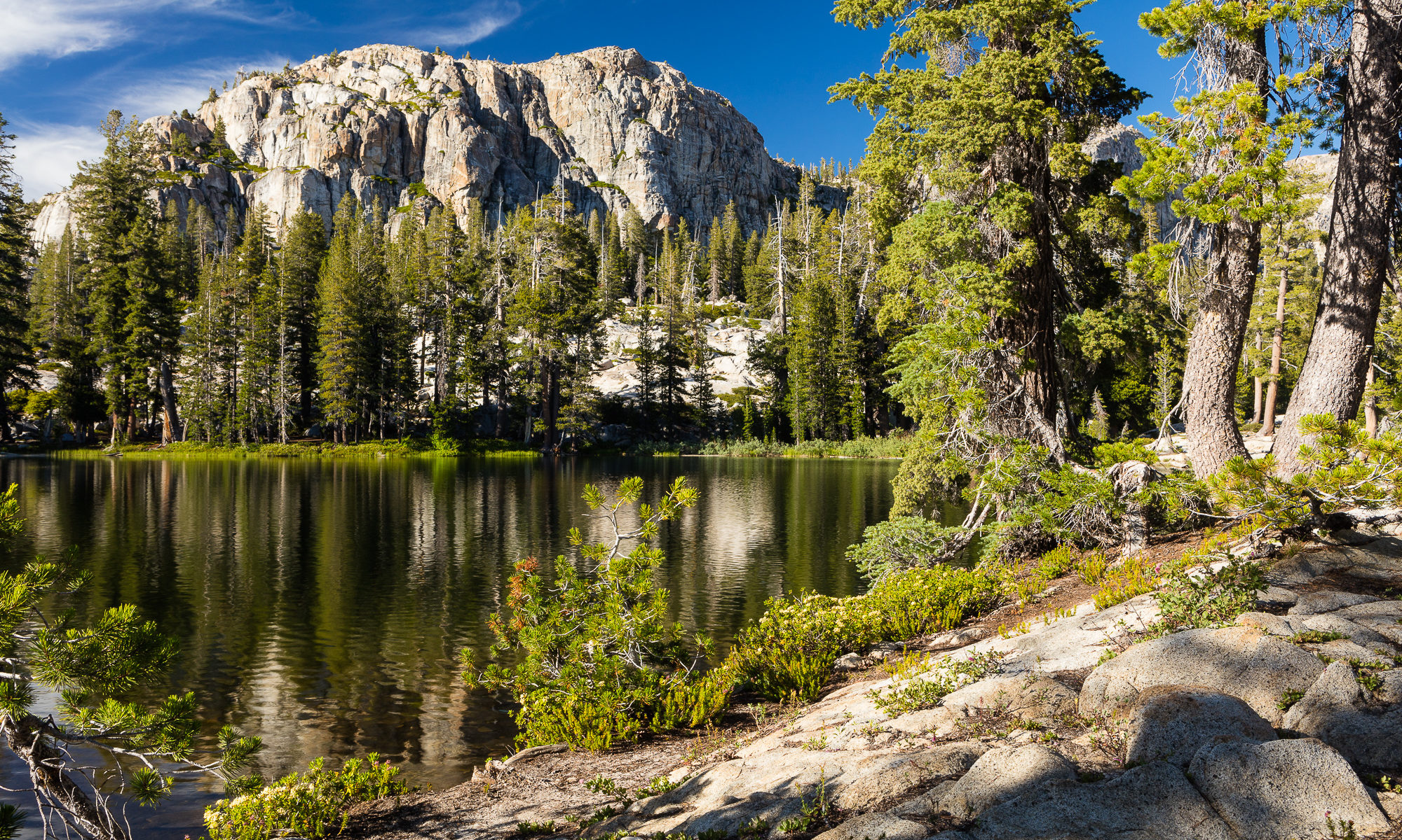
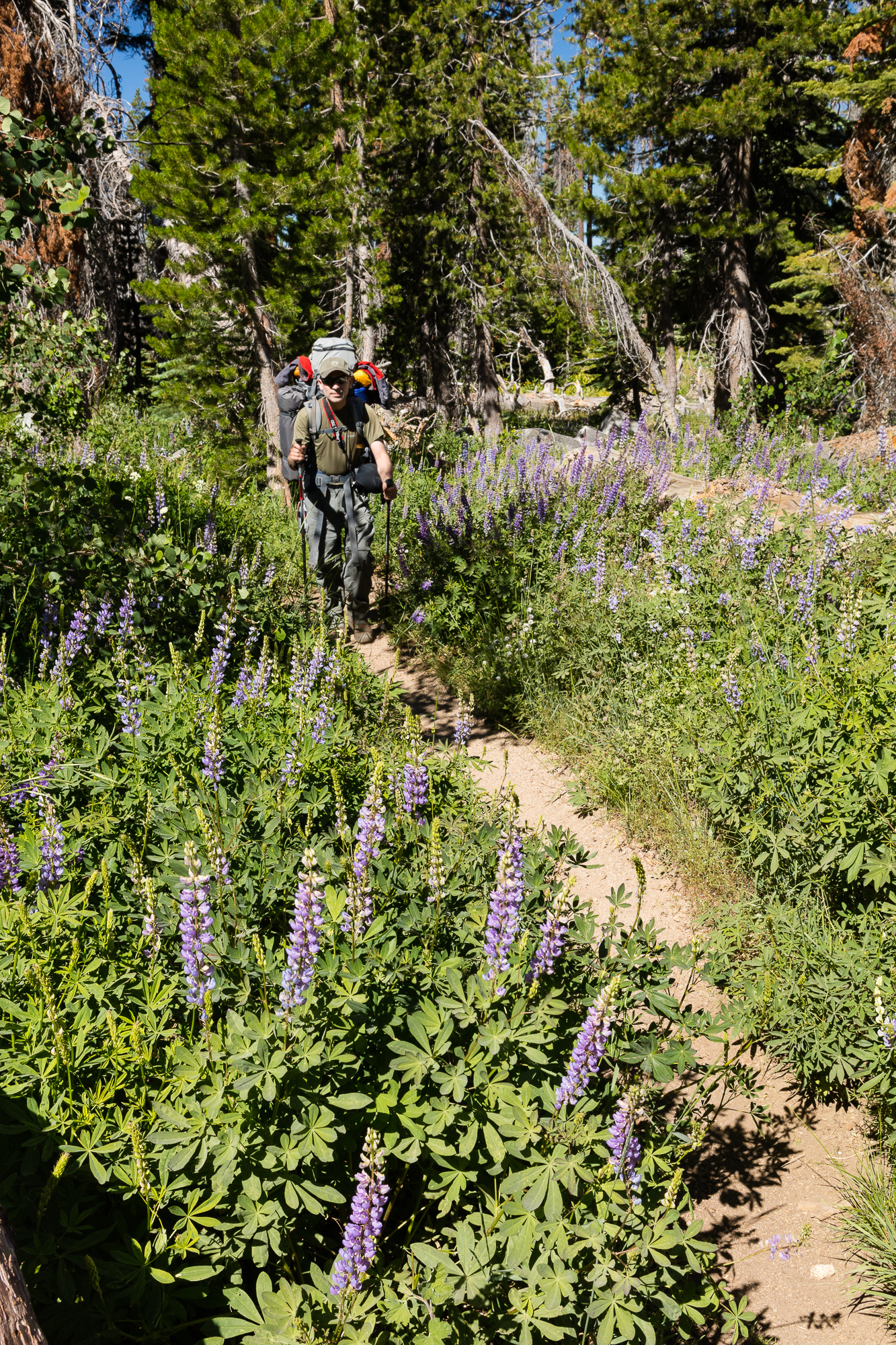
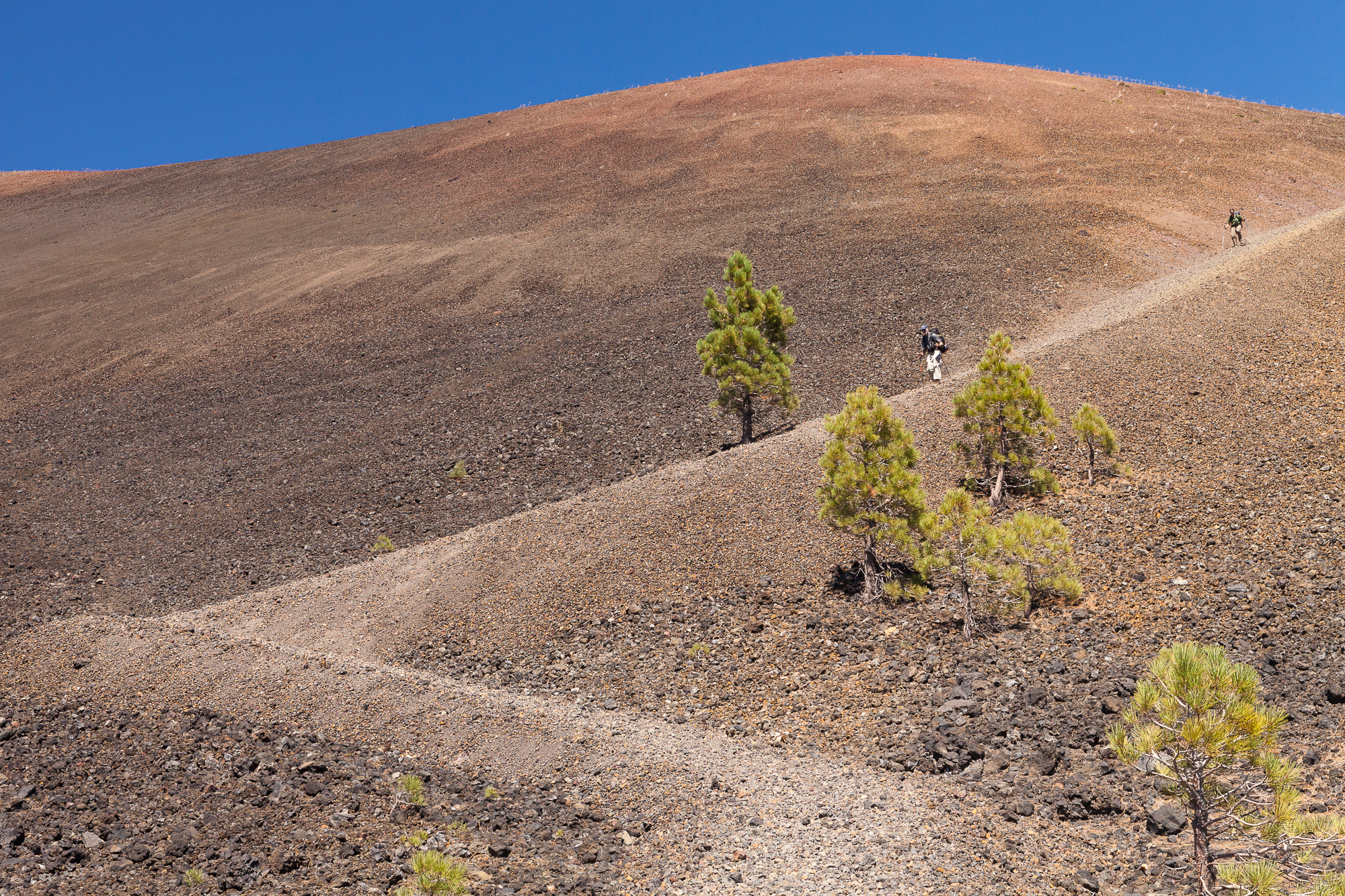
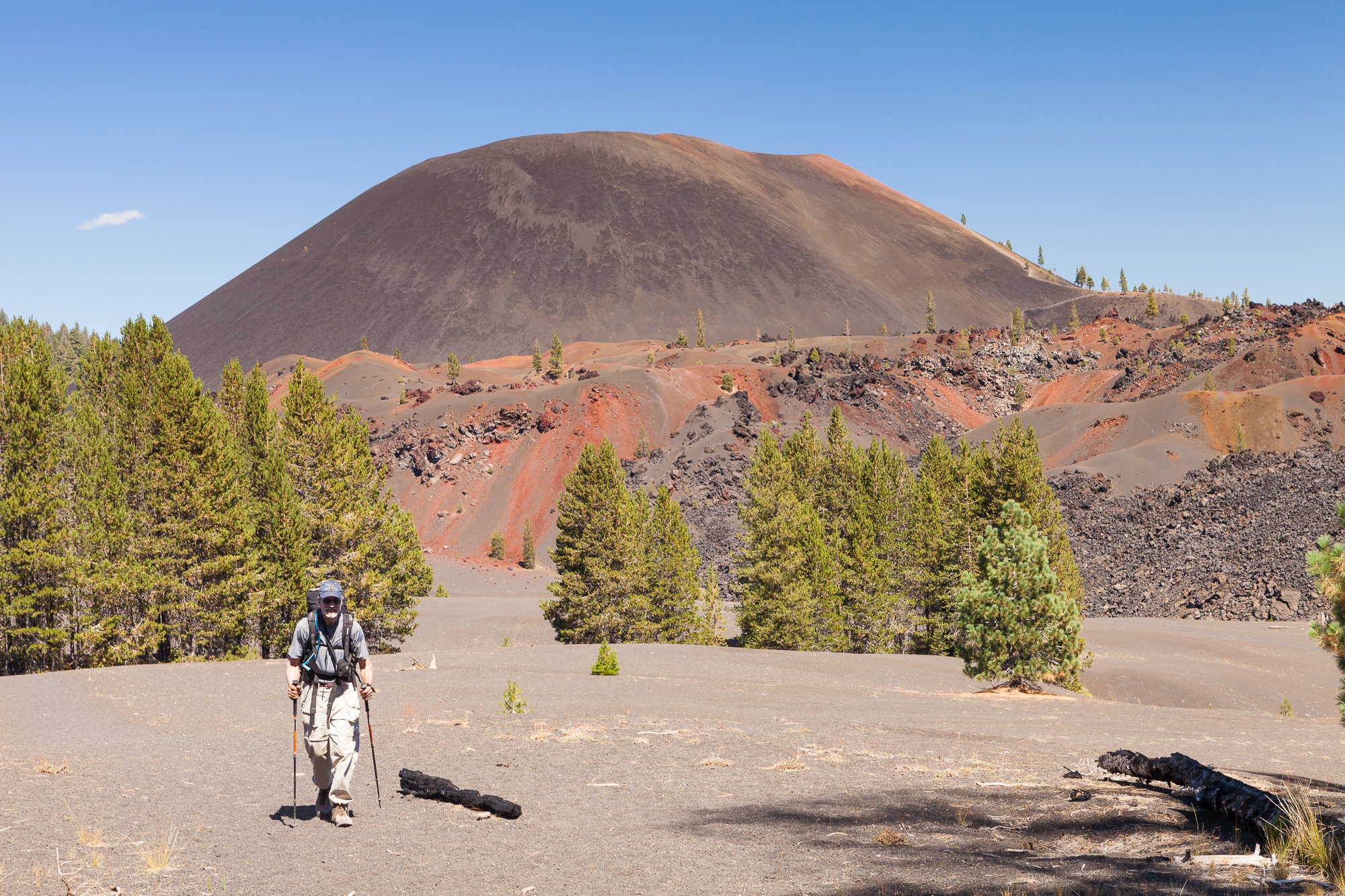
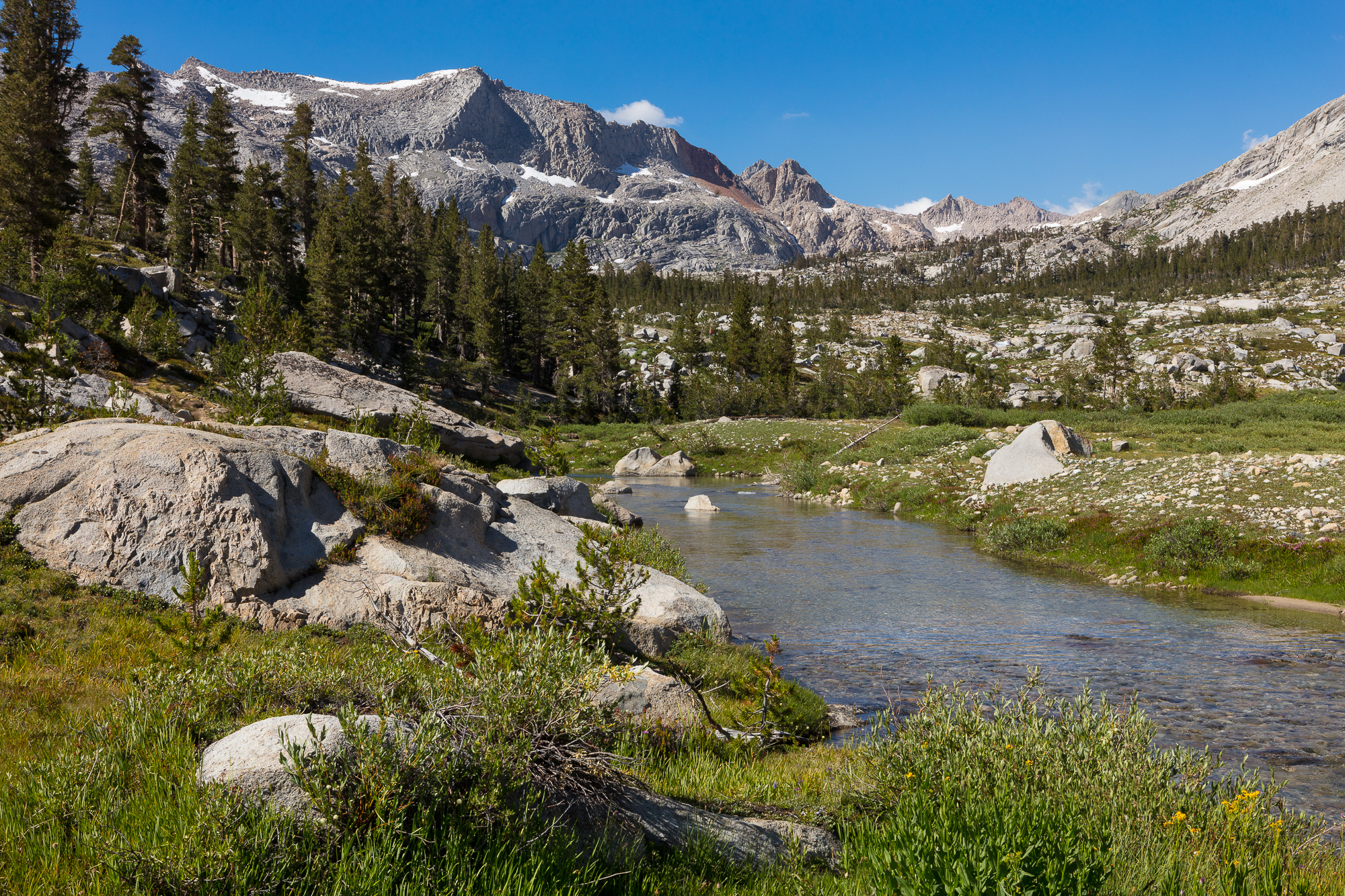
The next day we left our camp set up and day-hiked into a nearby basin dotted with lakes. This was somewhat challenging terrain and entirely off-trail. I had left most of my gear back at camp, including my photo gear, so this was taken with my cell phone camera. This allowed me to be more agile off-trail, while still able to capture my journey.

A waterfall flows into the Big Arroyo along the High Sierra Trail, Sequoia National Park
A waterfall flows into a creek prime for campsite drinking water, Sequoia National Park

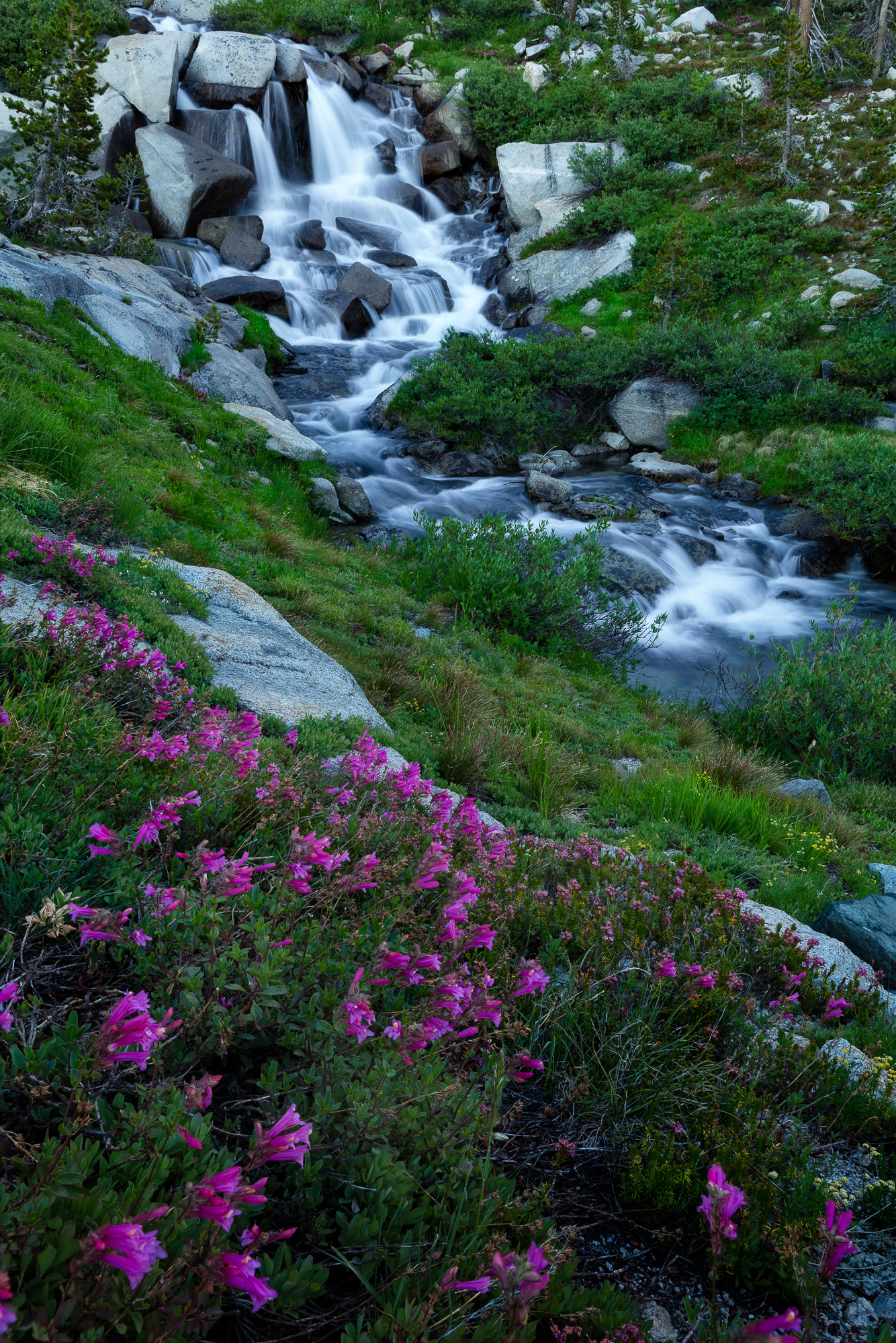
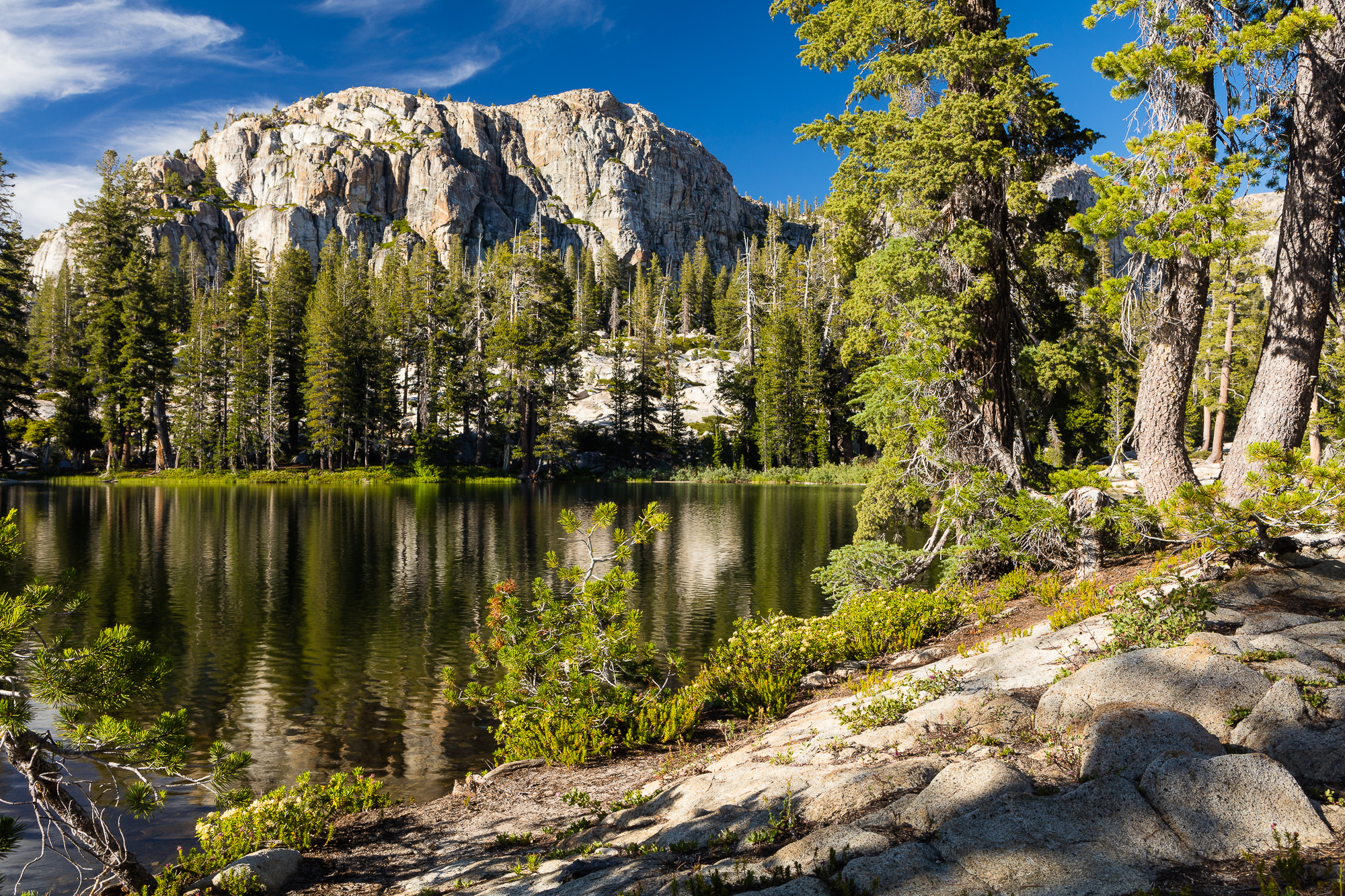
A second evening at our camp site gave us more time to explore the area, including this small waterfall just below our site. Once again, my camera gear did the proper job. Mounting the camera on a small travel tripod allowed me to not only focus stack but also to slow down the shutter speed to capture the motion of the water. This shot was far beyond the capabilities of the phone camera.

The big arroyo bubbles past the high sierra trail, Sequoia National Park
The Big Arroyo bubbles past the high sierra trail, Sequoia National Park

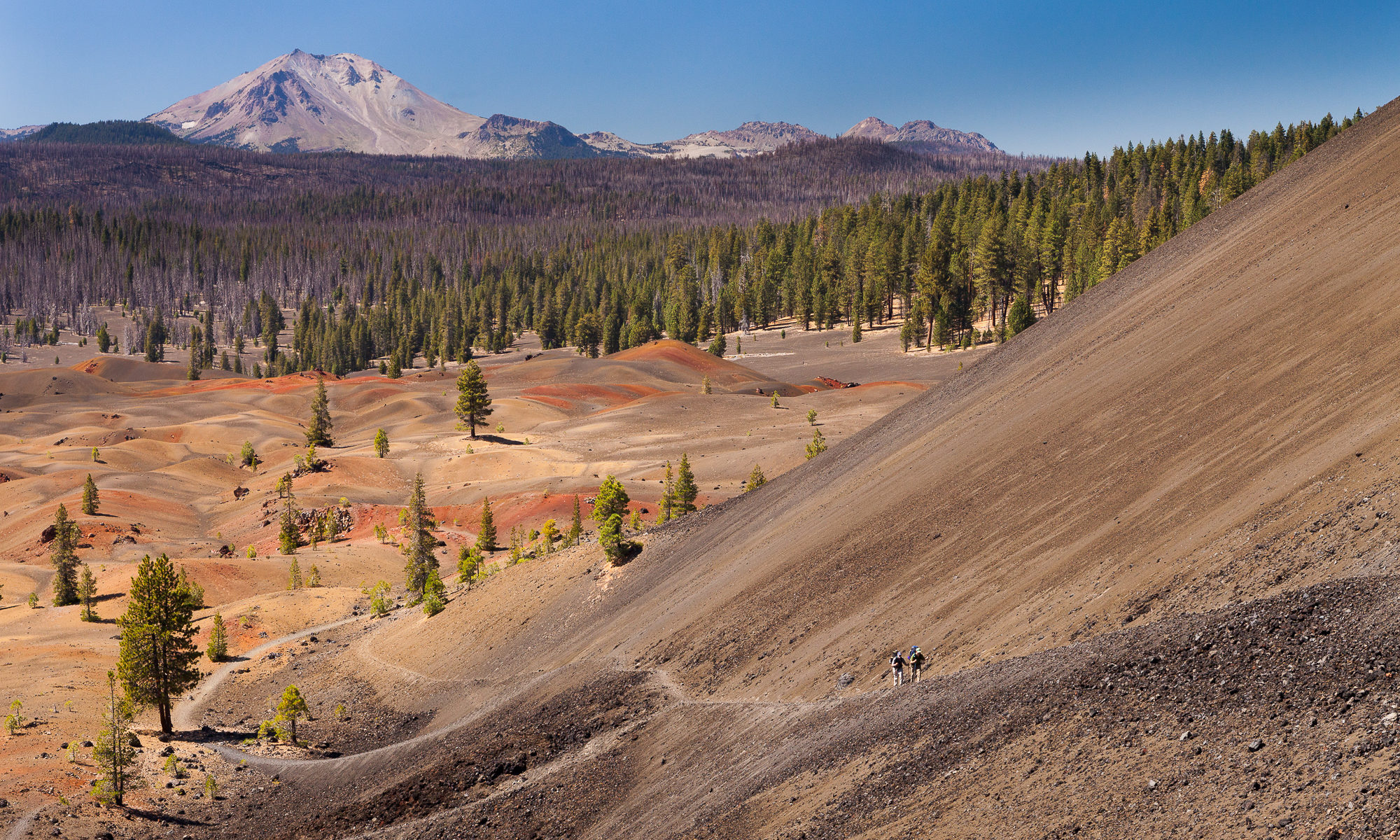
The next morning it was time to leave our mountain paradise and begin the journey home. Retracing our steps back down the canyon, we hiked past the serpentine route that the Big Arroyo cut through the valley floor.

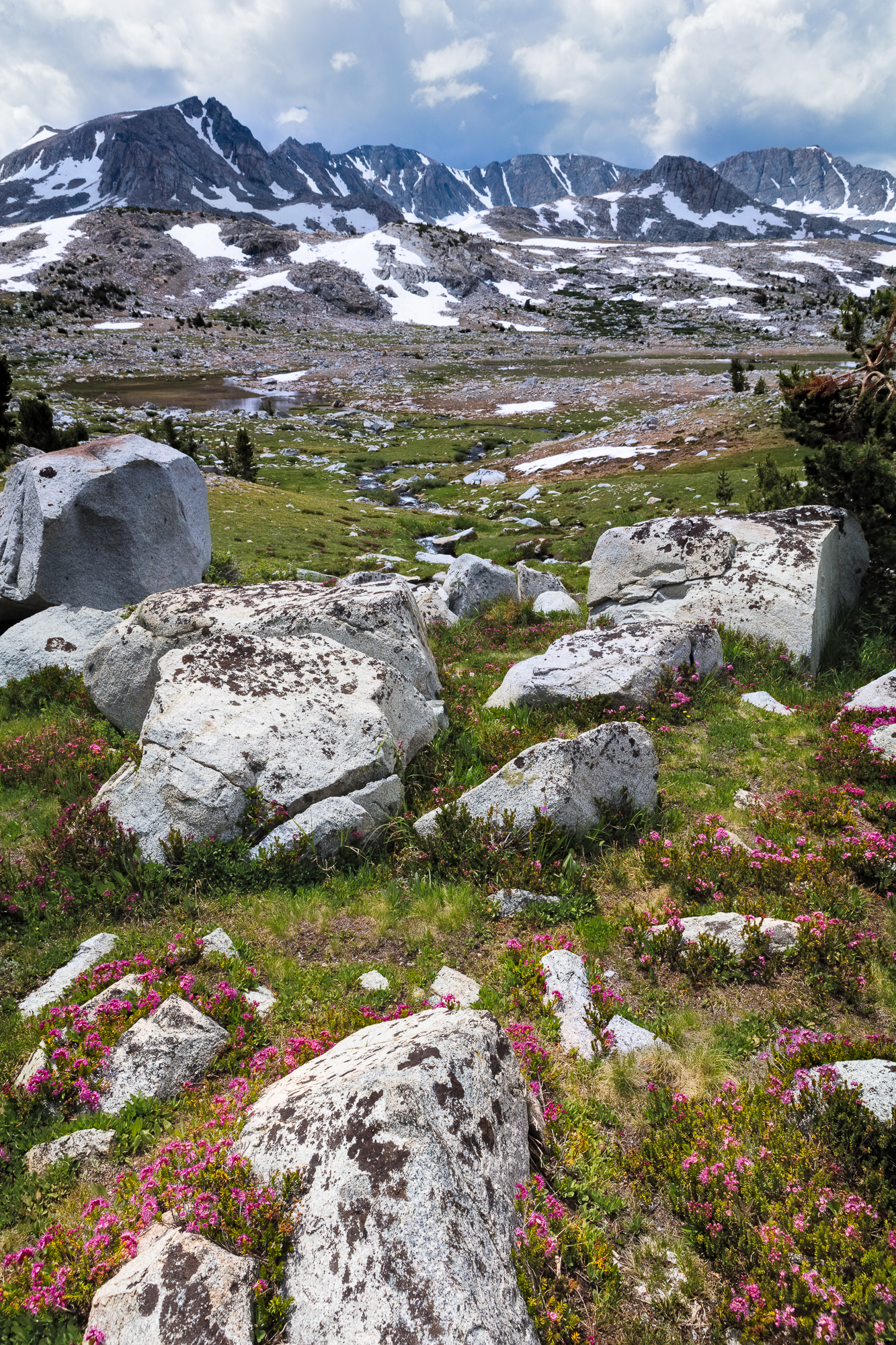
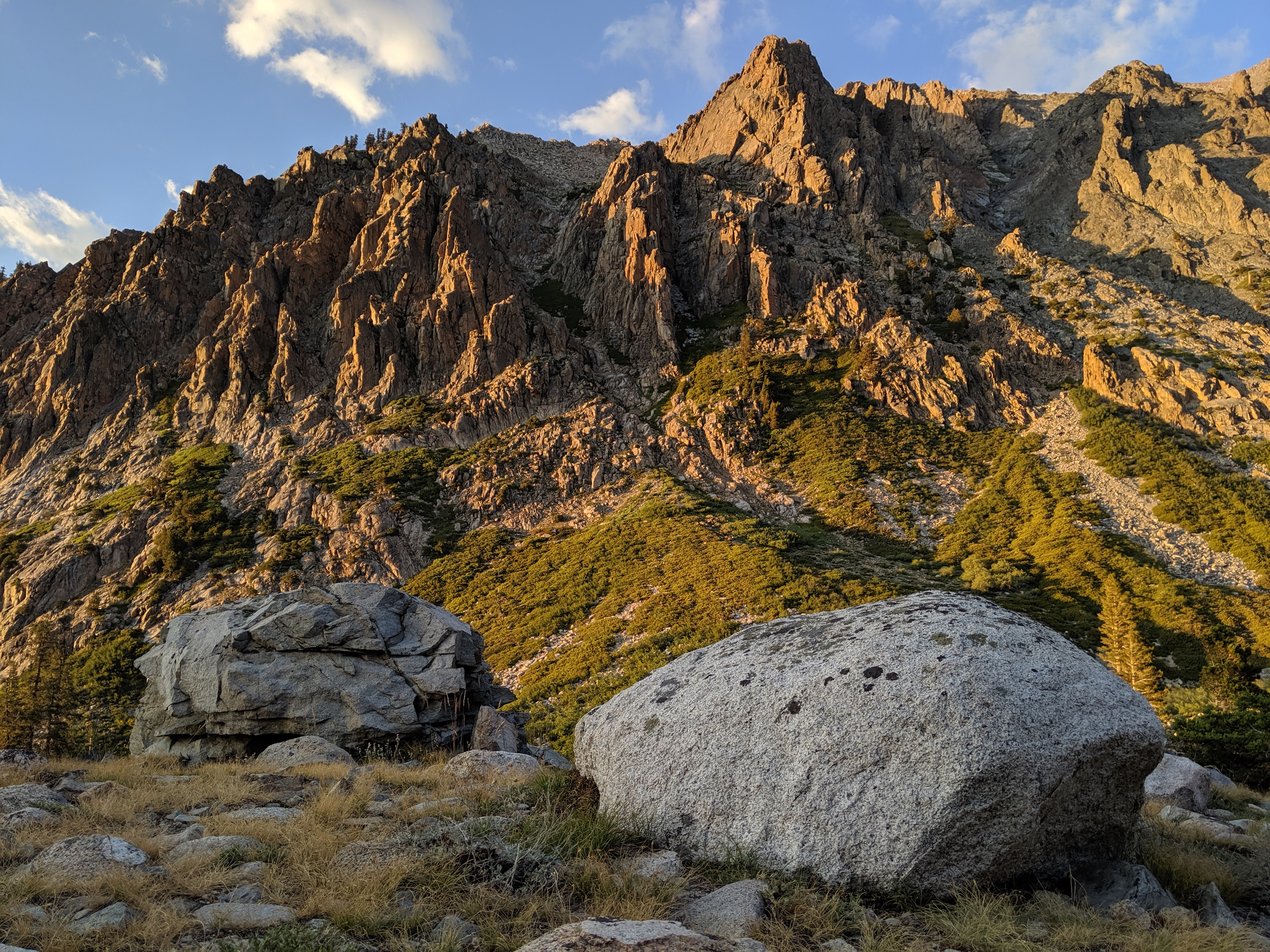
We spent the night in another valley, in the shadow of the Sawtooth Range, our destination for the next morning. I was a bit nervous for the following day, because we had a pretty brutal climb up to Columbine Lake, at which point the trail ended. We were planning to continue off-trail over the 12,000 ft pass next to Sawtooth Peak.

Columbine Lake sits below Sawtooth Peak, overlooking Sequoia National Park

Our final morning dawned a clear blue sky. With an early start we made Columbine Lake by 10 AM, and rested a bit before venturing over the pass. Although very steep, there was a relatively clear use trail with a series of ducks to guide the way. The only sketchy part of the climb was the need to traverse a large snow bank right before the pass. Class 4+ scrambling got us around it, though my heart was beating out of my chest as there were hundreds of feet of near-vertical scree below us. A slip here would not have turned out well.

Finally we hit the pass and it was a quick 8 miles of decent to get back to the car. As we drove back to the SF Bay Area, we realized that everything we could think of had gone according to plan. We reached our planned destinations, covered the entire Nine Lakes Basin, experienced the ultimate solitude and had a beautiful campsite for two nights.

My final verdict is that while my phone sports an amazing little camera, it couldn’t quite replace my heavier gear. I proved to myself the worthiness of carrying a heavy DSLR and tripod, especially if I expected to make portfolio-worthy wilderness photographs. The camera phone indeed was a great asset during the day while on the trail, making me reconsider how I carry my gear in the future. I might stow my DSLR and tripod away and plan to only use them from around camp during the golden hours. My phone is easy to access from a pocket while hiking, and photos with midday lighting are not as likely to become a quality print. Time will tell, but I look forward to more experimentation with the capabilities of this handy device.

Camera gear I used on this trip includes:

Piute Pass – Loads Of Snow, Swollen Creeks, And Busted Boot

Mt Goethe and surrounding peaks provide a panoramic view just over Piute Pass, Inyo National Forest, CA.

In August my friend Steve and I attempted a quick four day loop through parts of Inyo National Forest. Our plan was to ascend Piute Pass, head down the other side to Evolution Valley, and loop back up Darwin Canyon through Lamarck Col to complete the loop at North Lake. Sounded pretty simple, and going through some beautiful country. What we hadn’t planned on when creating the trip was how much snow was still in the mountains from the heavy winter. Even though it was August, snow still covered much of our trail.

As our trip date approached, we saw that not only would we have lots of snow to contend with, but also some very wet weather. Monsoonal moisture was pushing up from the east side of the Sierra, looking to drench our trip. After some deliberation, we decided to push forward, hoping for at least one clear evening or morning in Evolution Valley. I’d certainly put up with four days of rain for one beautiful landscape shot to add to my portfolio.

Snowmelt feeds waterfalls on the climb up to Piute Pass, Inyo National Forest, CA.

The climb up to Piute Pass was uneventful, passing a series of lakes on the way to the day’s high point. Glaciers clung to the northern slopes of the mountains, feeding small waterfalls. We did encounter several groups of happy campers who had spent the previous night at some of these lakes. I spoke briefly to a man named John and his son Clay who looked like they braved the nighttime rains in good spirits.

As we got closer to the top, I started seeing small fields of wildflowers. It was the right time of year for this elevation, but given how much snow was still in the mountains, I hadn’t been thinking of wildflowers at all.

Wildflowers adorn the meadows below Piute Pass, Inyo National Forest, CA

As soon as we were over the pass, we were treated to panoramic views of the mountains to the south. We had a short respite of flat ground, before the trail steepened and we descended into forest. As the rain started to fall, I donned my lightweight rain jacket and began to wonder if I was really prepared for potentially four days of rain. Soon we came across our first water crossing. The typical rock hop had swollen to a deep, fast flow, requiring the removal of my boots and a careful crossing. While the water was only up to my mid thigh, I began to worry about the crossings to come, knowing that some were much deeper.

Some days on the trail, the terrain wins the day. This was certainly one of those days. By the time we got to our campsite area, I was absolutely beat, and soaking wet from the five hours of downpour. Steve and I slogged around the area looking for a fire ring. Every spot that looked like it could work was under water. Between the rainfall and melting snow, there was so much water in the area that large pools formed in just about every flat space available. After about 45 minutes of searching, we finally found a place. I set up on a very wet slab of granite, hoping most of the water would run around my tent rather than under it. We heroically got a smoldering fire going, and tucked in for an early night.

The next morning, we woke to clear skies. However, everything I owned seemed to be soaked. Even my down sleeping back was wet on the outside, worrying me about warmth for the next cold night if it soaked through. We sat for a few minutes debating whether to push on, or just abandon and head back to the car. I was tired, wet, and worried about the difficult water crossings ahead. What finally swayed me was the discovery that my right boot was completely separating from the sole. This did not bode well for three more days of rough travel, much of it cross country. Time to head back to the car.

Wildflowers adorn the meadows below Piute Pass, Inyo National Forest, CA

Thus, with heavy hearts we repeated the terrain of day one. I tied some twine around my boot to hold it together and we climbed back up to Piute Pass from the west. Given that we had extra time to get back to the car, we stopped and took in a few beautiful wildflower displays on the western side of the pass.

Wildflowers adorn the meadows below Piute Pass, Inyo National Forest, CA

While we didn’t get to see the glory of Evolution Valley, it was beautiful country nonetheless. Even though it is always difficult when you don’t reach your goals, we still enjoyed a night out in the wilderness, 22 miles of challenging hiking, and some high elevation August wildflowers. Failed trip? Maybe. But it is hard to bemoan getting some solitude out in the natural world. It does much to replenish my soul, even when the going is tough.

Gear I used to create the photos in this post:

Gem Lake, Emigrant Wilderness

Last weekend I took a quick two night backpacking trip with some friends, in hopes of hitting the high country of the Sierra Nevada in peak wildflower season. I set my sights on Gem Lake in Emigrant Wilderness – just about the right elevation for flowers this time of year. Having been there before, I knew that even if the place wasn’t in bloom, we’d have a great time and see some amazing scenery.

I like Emigrant Wilderness because there are no trail quotas and it is very easy to get a wilderness permit with short planning. We set out from the Bay Area early Friday morning, stopping at the Mi Wuk Ranger Station on the way up Highway 108. Even though we were taking our time, we still hit the trail by 10AM, plenty of time to reach our 10 mile destination of Gem Lake.

A backpacker hikes along the trail from Crabtree Camp trailhead to Gem Lake, Emigrant Wilderness, CA.

The trail meanders between thick forest and open granite-filled vistas. Most of Emigrant Wilderness is easily accessible cross country due to many gently-sloping wide open granite bowls and domes. This time we stuck to the trail, and made easy progress. Every so often we were rewarded with a scenic vista. If you are not already a lover of granite, after a few hikes in this part of the Sierra you soon will be!

Cliffs to the north of Gem Lake reflect in the still water at sunset, Emigrant Wilderness, CA.

The elevation changes were just enough to tire our bodies by the time we reached Gem Lake. This lake certainly lives up to its name. However, it is very popular and can get quite crowded on the weekend. As it was Friday night, we were able to relax lakeside in relative peace. As the sun set, the wind settled and we got some nice reflections on the water.

Cliffs to the north of Gem Lake reflect in the still water at sunset, Emigrant Wilderness, CA.

The next day we went further up trail and explored Jewelry Lake and Deer Lake. Deer Lake is much larger and Gem or Jewelry, and it was hot enough to warrant a midday dip in its cool waters. This is a great area to take your time and not hurry along the trail. One more night, and it was time to head back.

A winding stream flows into Jewelry Lake, Emigrant Wilderness, CA.

Luckily there were plenty of wildflowers along the trail to keep us entertained. We had perfect weather for our 26 mile journey and everyone enjoyed the change in scenery.

A backpacker hikes along the trail from Crabtree Camp trailhead to Gem Lake, Emigrant Wilderness, CA.

With its easy access and lack of quotas, this is the perfect place for an impromptu night or two in the wilderness.

Gear I used to create the photos in this post:
[amazon_link asins=’B00IAYFDIC,B00T3ERT5S,B0076BNK30,B0079RQZBU,B00OD71FKU’ template=’ProductCarousel’ store=’hankchristens-20′ marketplace=’US’ link_id=’617616e6-918b-11e7-b259-8df1aecbb1d9′]

Lassen Cinder Cone

The Lassen Cinder Cone forms a large round hill when approached from the west, Mt Lassen National Park.

A couple of summers ago I met my brother and dad in Mt. Lassen National Park for a backpacking trip. This park sees one fraction of the backpacking that other national parks get. As a result, you get the feeling of having the back country to yourselves. More importantly for me, this trip would revolve around revisiting the Lassen Cinder Cone that sits in the east part of the park. We had been there many years before on a day hike, but backpacking would give me more time to explore it photographically.

A backpacker is dwarfed by the large Lassen Cinder Cone as he heads up the steep trail to the top, Mt. Lassen National Park.

We spent the night at Snag Lake, and in the morning, approached the Cinder Cone from the south. From there, we reached the steeper of the two trails that wind to the top. In the photo above, you can see my brother as a small speck as we neared the cone from the west.

Two backpackers climb the steep southern trail up the Lassen Cinder Cone. Mt Lassen and the Painted Dunes can be seen to the west.

The trail to the top is built using the loose volcanic scoria that makes up the cone itself. It is only a little more solid than walking up a sand dune, and is not for the faint of heart. This is due not only to the phyisical exhaustion that comes from pushing up such a slope, but also the steepness of the trail itself. At times I felt like I was going to tumble backward down the trail as my backpack made me somewhat off balance.

A large cinder cone sits to the east of Mt. Lassen in Northern California. A trail decends a hundred feet into the mouth of the cinder cone to a large steam vent.

Those who reach the top are rewarded with spectacular views of Mt. Lassen to the west, as well as a chance to peer down into the crater of the cone. A trail even descends into the mouth of the crater, where you can stand next to thermal steam escaping from the ground.

The cinder cone was formed long ago by many small eruptions that threw lava into the air, which cooled into the loose, porous volcanic rock. Over time, this piled up into the 700 foot tall cone that we see today. It is thought to have erupted as recently as the 1650s, though the only activity that remains today is the steam rising from the crater.

A backpacker looks at Mt. Lassen from the top of the Lassen Cinder Cone.

Walking to the western edge of the crater, we were rewarded with views directly across from Mt. Lassen, as well as views of the Painted Dunes below.

The Painted Dunes extend to the forest surrounding Mt. Lassen in Northern California. These volcanic dunes were formed by a thousand year old cinder cone.

The painted dunes are pumice fields formed by oxidation of volcanic ash from earlier eruptions of the Cinder Cone. Its beautiful colors formed because the ash fell on lava that was still hot and forming.

Two backpackers decend the steep southern trail of the Lassen Cinder Cone, Mt Lassen National Park.

After a while at the top, and after we tired of braving the fierce wind, we descended the way we had come up. I tried not to think about the consequences of losing my footing, and took it step by step.

A backpacker heads west away from the Lassen Cinder Cone, Mt Lassen National Park.

Soon we were down and continuing our day’s hike to our destination of Summit Lake. The promise of camp chairs and cold beer quickened our step. It was great to spend time up close with this unusual creation of nature.

Copyright 2017 Hank Christensen