Lake Vernon Loop

The spray from Wapama Falls creates a rainbow as it rushes into the Hetch Hetchy Reservoir, Yosemite National Park

Recently a friend and I headed up to Yosemite for an early season 4-day backpacking trip. It was a good excuse to loosen up the joints for the summer and get out in the Sierra backcountry. We chose the area around Lake Vernon as sort of a staging point from which to launch an off-trail loop into some of the less explored drainages. Supposedly, this area was relatively snow-free compared to other areas at similar elevation (7,000 – 9,000 ft).

We decided to hike up out of Hetch Hetchy due to the easy access. Because permits are issued at the entrance gate, you can get a wilderness permit the night before as late as 9pm. That is a huge help for those driving up after work from the Bay Area. We got there Friday night, got our permit, and settled in at the backpacker’s campground overlooking O’Shaughnessy Dam. We were up at 5:30 the next morning, and hit the trail by 7am. We had a very long day of hiking and lots of climbing, so we needed the early start.

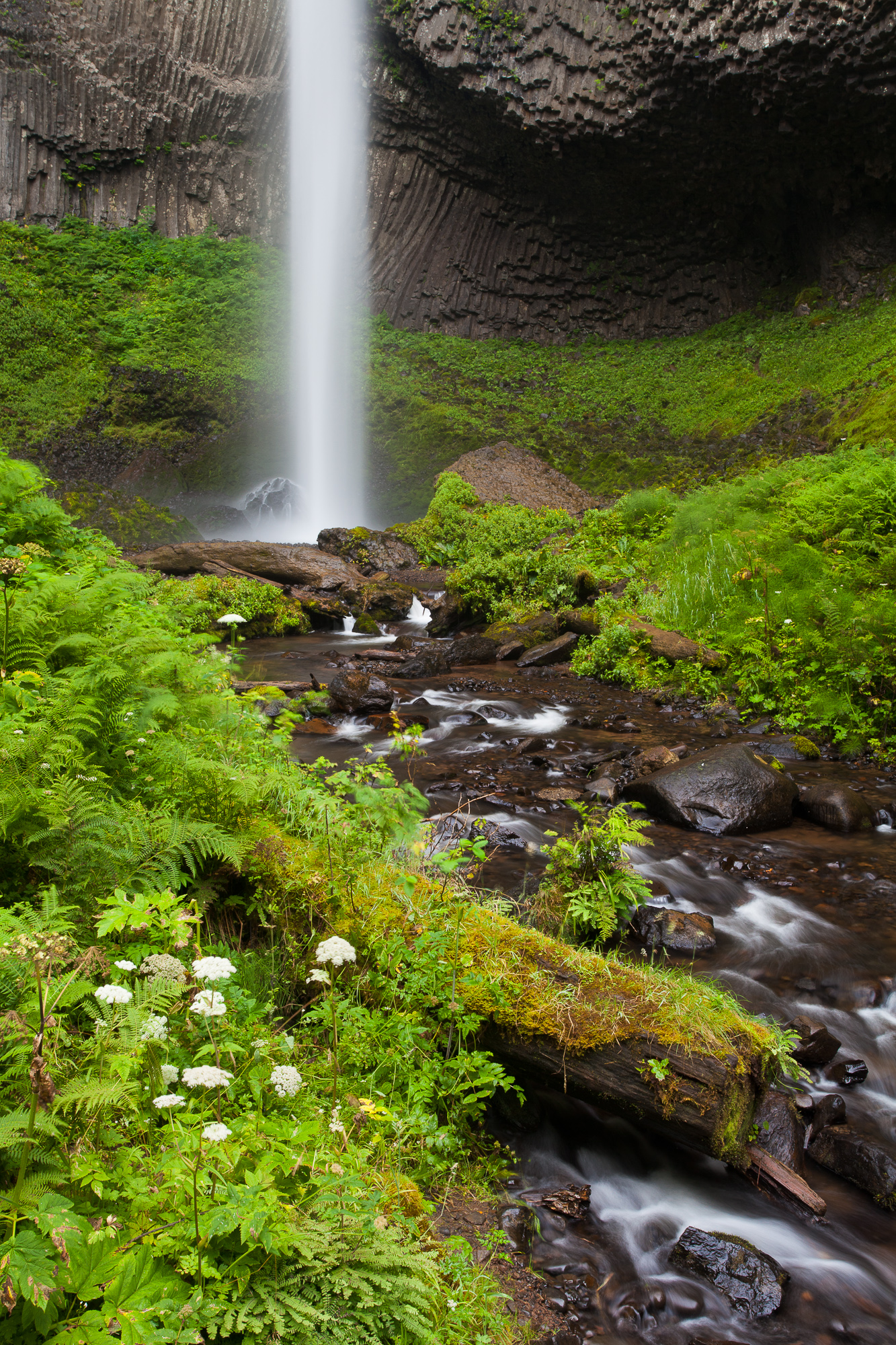
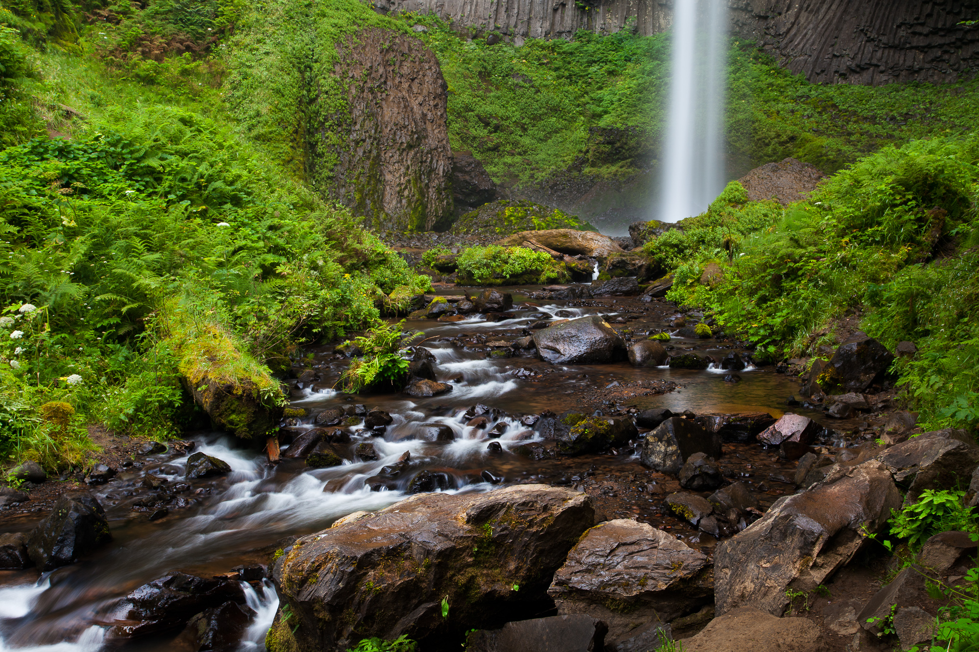
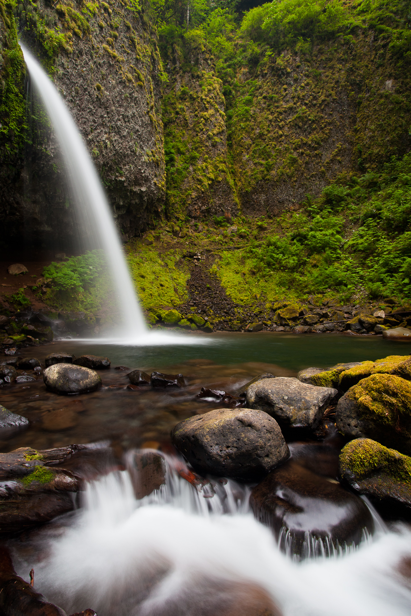
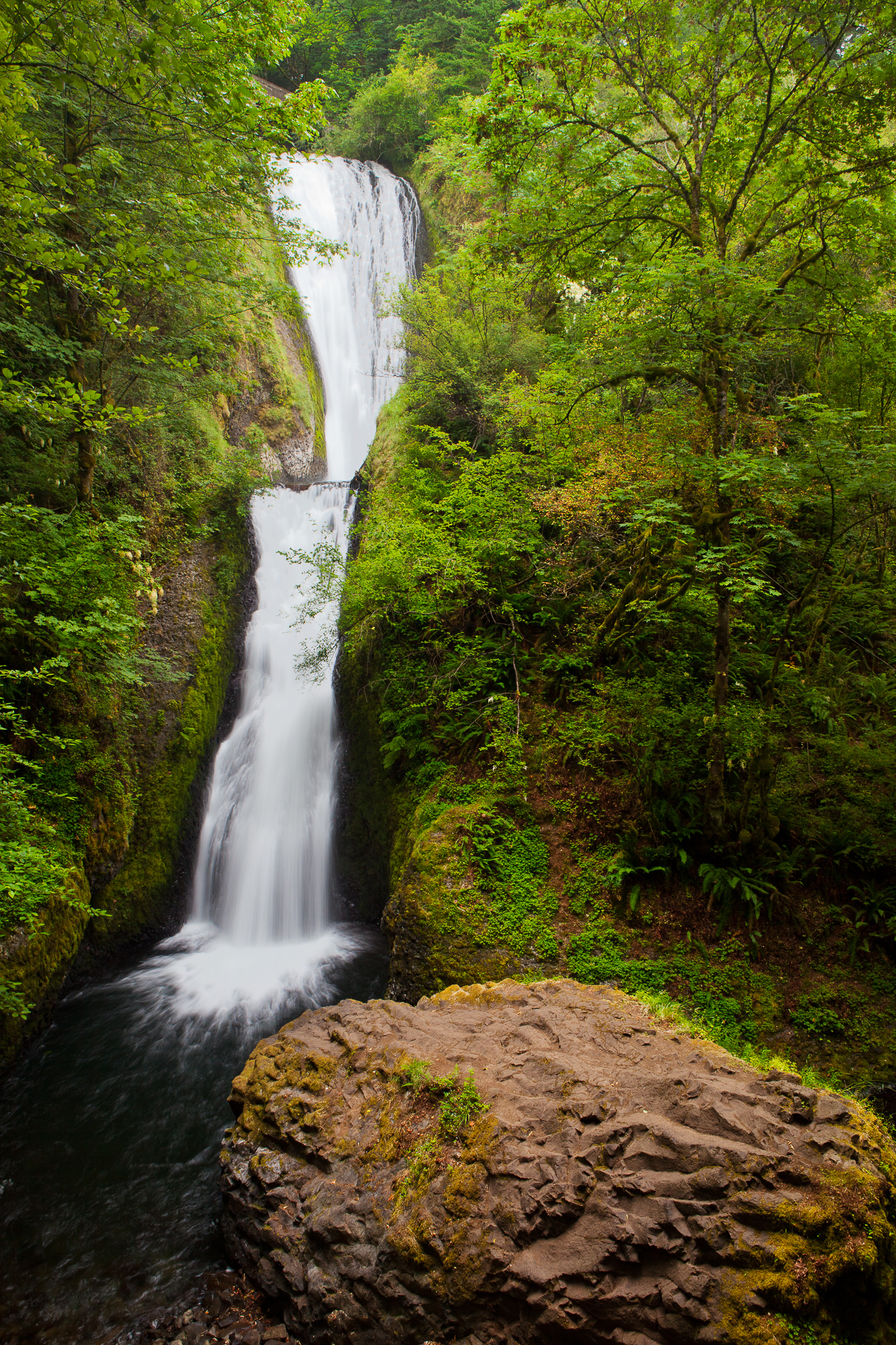
The uneventful hike along the edge of Hetch Hetchy reservoir was punctuated only by the raging waters of Wapama Falls (see photo above). A couple of weeks earlier, the flow from the fast snow melt was so great that park rangers closed the bridges across the falls and shuttled people by boat around the dangerous spots. I was happy that we timed it such that it was a easy walk through the water spray.

We reached Rancheria Falls by 9:30 and began our long climb up out of the lower elevations of Hetch Hetchy. After a long day of absolutely nowhere to camp (not that we were ready to stop anyway), we reached our destination of Lake Vernon. It ended up being a 16 mile day with 4800 ft of elevation gain. Not surprisingly, we were pretty worn out for a first day of the season! With little time to scout before it was fully dark, I set my alarm to wake up before sunrise and do some quick scouting for shots along the shoreline.

Twisted trunks of trees are reflecting in Lake Vernon are silhouetted against the pre-dawn light, Yosemite National Park

One of the features of the lake that struck me was that all along the shoreline, trees were growing directly out of the water. I’m guessing that the Lake was at peak capacity and was flooding the base of the trees, but it definitely made for an interesting silhouette abstract. The sun soon rose into a cloudless sky, and we were quickly packed up and ready to hit the trail once again.

Above Lake Vernon, we hit quite a few places where the trail was under one to two feet of water. Large patches of snow began appearing amongst the trees. As we climbed higher, we began to worry about our original plan of climbing off trail to 9,000 feet and from there, exploring some of the ridge lines. As we got closer to our destination, we could see the ridges were still full of snow. With no choice but to change our plans, we camped up above Lake Wilma on some flat granite slabs next to a quiet cascade.

Water cascades down flat, open granite above Wilma Lake, Yosemite National Park

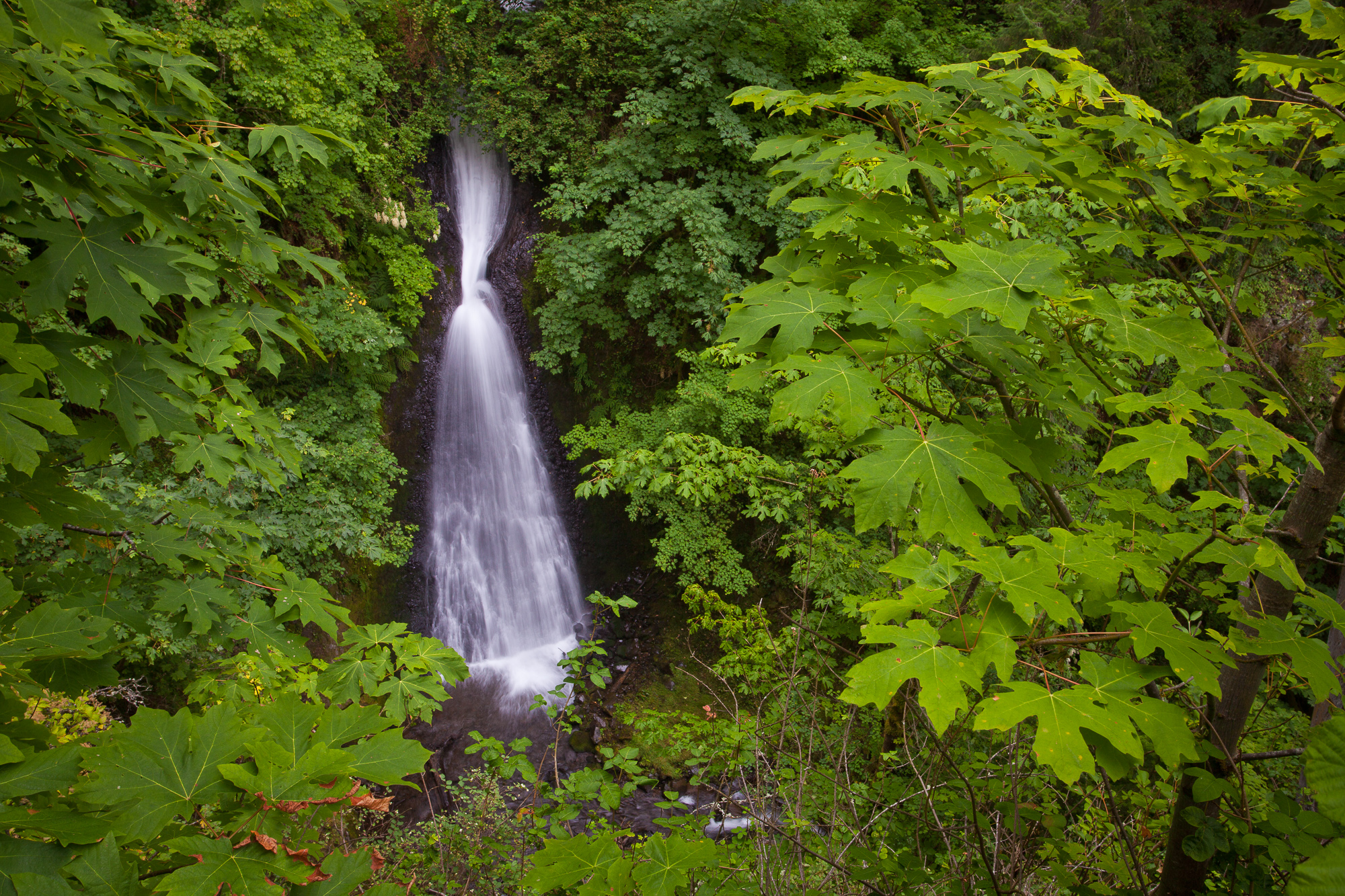
The next morning we decided that the best course of action was to more or less retrace our steps back to Lake Vernon, as we were pretty worn out from trudging through flooded meadows and snow drifts. At least this day would be mostly downhill (only 1500 ft of elevation gain), as the previous two days combined were close to 8,000 ft of gain. Walking downhill most of the day allowed us to enjoy the beauty of Falls Creek, which the trail followed most of the day.

We set up camp in the same spot along Lake Vernon that we had used two nights earlier. A bonus was getting to use the rest of the firewood we had already gathered! The next morning was quiet and beautiful. The surface of the lake had settled into a mirror, reflecting everything along the shore with perfection.

A large pine grows out of a pile of granite boulders along the shore of Lake Vernon, Yosemite National Park

After enjoying a leisurely morning at the lake, we didn’t hit the trail until 9:30, our latest start yet. That was okay, because we had only an 11 mile hike out to the car, downhill almost the entire way. We left the lake opposite our entry point, creating a loop from Hetch Hetchy to Lake Vernon. We made quick time, blasting out of there in 4 1/2 hours. The most scenic part of the last day was descending the old construction road from Beehive Meadows. This was a road built to service the building of the dam, which has been converted into a hiking trail. A few chunks of asphalt were still seen here and there, but for the most part, mother nature had wiped out this road long ago with severe freeze/thaw cycles and many rock slides. Although the exposed decent was hot and hard on the joints, it did offer some stunning views of the reservoir.

Lupine blooms adorn the hillsides surrounding the Hetch Hetchy Reservoir, Yosemite National Park

As I was reaching the waterline, I couldn’t help but try to visualize what this valley would look like in its original condition, before the dam was built. I couldn’t help but feel a touch of remorse as I imagined John Muir shaking his head in disgust.

We reached the car by 2pm and began the drive home. It was a great first trip of the season, clocking in at 3 1/2 days of hiking, just over 50 miles covered, and over 10,000 ft of elevation gained. If this was a warmup trip, what’s the next trip going to be like?

Upcoming Publication – Backpacker Magazine

Berry Creek Falls can be seen through the lush redwood forest, Big Basin Redwoods State Park

Check out next month’s newsstands for the latest issue of Backpacker Magazine. They are running one of my photos as part of an article about the Skyline To The Sea trail, which runs from the crest of the Santa Cruz mountains to the ocean.

I took this photo while out shooting on spec for a different article a few years ago. That one never made it to publication, but with photography, you never know when you’ll get a second (or third or fourth, etc) chance!

Waterfalls of the Columbia River Gorge

Latourell Falls drops straight down from an overhanging basalt cliff, Columbia River Gorge, Oregon
Wild flowers adorn the creek that descends from the base of Latourell Falls, Columbia River Gorge, Oregon

Earlier this summer I spent a couple of mornings in the Columbia River Gorge, photographing just a few of the many waterfalls that line its cliffs. Luckily, I was blessed with Oregon’s trademark high overcast skies, which gave me the perfect diffused light with which to do forest photography. By cutting out all the scattered light beams filtering through the canopy, I was able to get even light across the entire scene, and reduce the dynamic range to something my camera could handle.

Latourell Falls drops straight down from an overhanging basalt cliff, Columbia River Gorge, Oregon

The two preceding images are of Latourell Falls, which seems to have endless foreground opportunities. While most of the falls in the Gorge cascade down rock faces, this waterfall plunges off an overhanging basalt cliff, allowing the water to fall straight down. Since there are never any true straight lines in nature, having a strong vertical line to work into the composition can be a lot of fun.

Ponytail Falls shoots outward from a cleft in a rock cliff, and cascades over large stones below, Columbia River Gorge, Oregon

Ponytail Falls sits upriver from Horsetail Falls, a much larger waterfall closer to the road. While Ponytail may be inferior to its companion in size, it makes up for it in beauty. This fall shoots out from a notch in the cliff, creating a pleasing arc of water. A hiking trail wraps around the base of the cliff behind the waterfall, giving hikers the added bonus of seeing the fall from a different perspective.

Shepperds Dell Falls empties into a narrow canyon overgrown with greenery, Columbia River Gorge, Oregon

Shepperd’s Dell Falls is absolutely covered with green. This is a nice tidy little waterfall that starts well below the trailhead, allowing views from high above looking down. Of course, shooting so much foliage makes using a polarizer a must. This will cut all reflections on the leaves, and really make the green color pop. This is an effect that cannot be replicated well in post processing.

The river below Wahkeena Falls cascades past a fern, Columbia River Gorge, Oregon

Just below Wakheena Falls is a beautiful cascade that runs past lush ferns and wild flowers. It is not as well visited, as it is tucked away below the road, and most visitors are drawn immediately to the waterfall.

Bridal Veil Falls empties into a small pool surrounded by dense forest, Columbia River Gorge, Oregon

The last waterfall I covered in this trip was Bridal Veil Falls. This is one of the more popular waterfalls along this stretch of road. Equally as popular is the Bridal Veil post office, which receives boxes of wedding invitations from all over the world, so that the invitations can be postmarked by the town of “Bridal Veil” and mailed out to potential wedding guests.

I have to admit, I had a little trouble with the aesthetics of this waterfall. The shot above is a straight-forward interpretation, shot from an (ahem) observation platform. Okay, let’s be honest – it is a vacation snapshot! I wasn’t very happy with this rendering, as I felt it lacked conveying the almost ethereal quality of the grotto that this waterfall plunged into. I worked the scene and settled on the more distant perspective below.

Bridal Veil Falls opens up into a creek that flows through dense forest, Columbia River Gorge, Oregon

The best part of this photo excursion is that I only scratched the surface of the multitude of waterfalls along the Gorge. With so much water flowing into the Columbia River, and so many overcast days (smile), this area really can be a photographer’s paradise.

Gear I used to create the photos in this post:
[amazon_link asins=’B007FGYZFI,B0076BNK30,B00009R6WO,B00IAYFDIC’ template=’ProductCarousel’ store=’hankchristens-20′ marketplace=’US’ link_id=’1e2a6983-927e-11e7-b829-e91a331daddd’]

Ten Lakes, Yosemite National Park

After waiting all summer for the snow to melt out of the high country, I finally ventured north of Tioga Road with some friends from college for a weekend backpacking trip. Instead of my usual high mileage days, our focus was on leisure time in the backcountry, which gave me plenty of time for photography. We hiked into the Ten Lakes region – an area featuring a chain of lakes with forested streams in between them, all draining into the Tuolumne River far below.

A calm lakes reflects the surrounding cliffs in early morning, Ten Lakes, Yosemite National Park
A calm lakes reflects the surrounding cliffs in early morning, Ten Lakes, Yosemite National Park. Canon 24-70mm f/2.8L lens with the EOS-5D MkII. ISO 100. Evaluative metering 0 EV: 1/6 sec. at f/16. Stitched vertical frames creating a 44 megapixel image.

We found a campsite at the far end of a small lake. The site was situated atop a thirty foot cliff, giving us a commanding view of the lake and surrounding cliffs. Behind us rose an unnamed granite peak, offering the camp a nice backdrop. Best of all however, was the nearby stream dropping from an upper lake into the lake below. There was an endless variety of small pools and cascades, giving me plenty of material to work with.

A stream runs between two lakes in the Ten Lakes chain, forming a small cascade, Yosemite National Park
A stream runs between two lakes in the Ten Lakes chain, forming a small cascade, Yosemite National Park. Canon 24-70mm f/2.8L lens with the EOS-5D MkII. ISO 50. Evaluative metering -2/3 EV: .6 sec. at f/16.

Just before sunset on our first night, the clouds started moving in. While other campers might have cast a worrisome eye to the skies, I was elated. I knew that the chance for a dramatic sunset was greatly increased with the changing weather conditions, and thankfully I was rewarded with one. The best part – I only had to walk about ten yards from our campsite to get the view I wanted. Given it required almost no work on my part, I almost felt guilty.

The dramatic skies of sunset are reflected in one of lakes of the Ten Lakes chain, Yosemite National Park
The dramatic skies of sunset are reflected in one of lakes of the Ten Lakes chain, Yosemite National Park. Canon 24-70mm f/2.8L lens with the EOS-5D MkII. ISO 100. Evaluative metering -2/3 EV: 2.5 sec. at f/16.

The next morning was bright and clear. I woke up early to explore the area, and see what the morning had to offer. Our little lake looked quite different in the morning, and I took advantage of the still air to get a nice reflection in the background of a camp-side stream photo. I can never get enough of Sierra Nevada granite.

Trees and vegetation grow amid Sierra granite, Ten Lakes, Yosemite National Park
Trees and vegetation grow amid Sierra granite, Ten Lakes, Yosemite National Park. Canon 24-70mm f/2.8L lens with the EOS-5D MkII. ISO 50. Evaluative metering 0 EV: 1.3 sec. at f/16.

Working my way up the stream, I found a spot where I could capture the running water with the peak that rose above our site.

A stream cascades down slabs of granite below an unnamed peak, Ten Lakes, Yosemite National Park
A stream cascades down slabs of granite below an unnamed peak, Ten Lakes, Yosemite National Park. Canon 24-70mm f/2.8L lens with the EOS-5D MkII. ISO 50. Evaluative metering -2 EV: .6 sec. at f/18.

This day was a rest day – full of fishing and exploring some of the other lakes in the chain. Working our way up to a higher lake, we saw there were still huge slabs of snow right at the shoreline. Going higher still, we found a lake with no fish, but a perfect spot for a mid day swim. There is something very special about having an entire lake to yourself in the most populated state in the nation. Of course, along the way, I also had plenty more opportunities for photos.

A stream cascades through a forest in the Ten Lakes region of Yosemite National Park
A stream cascades through a forest in the Ten Lakes region of Yosemite National Park. Canon 24-70mm f/2.8L lens with the EOS-5D MkII. ISO 50. Evaluative metering -2/3 EV: 1/6 sec. at f/16.

After exhausting ourselves and getting a great night of sleep, it was time to head back to the real world. It was a great trip, with beautiful landscape and only seven miles of hiking each way. While the location was not as remote as most of my Sierra trips, I enjoyed the slower pace and additional time for photography. I’ll definitely have to work in more trips like this in the future!

Copyright 2017 Hank Christensen