Lassen Cinder Cone

The Lassen Cinder Cone forms a large round hill when approached from the west, Mt Lassen National Park.

A couple of summers ago I met my brother and dad in Mt. Lassen National Park for a backpacking trip. This park sees one fraction of the backpacking that other national parks get. As a result, you get the feeling of having the back country to yourselves. More importantly for me, this trip would revolve around revisiting the Lassen Cinder Cone that sits in the east part of the park. We had been there many years before on a day hike, but backpacking would give me more time to explore it photographically.

A backpacker is dwarfed by the large Lassen Cinder Cone as he heads up the steep trail to the top, Mt. Lassen National Park.

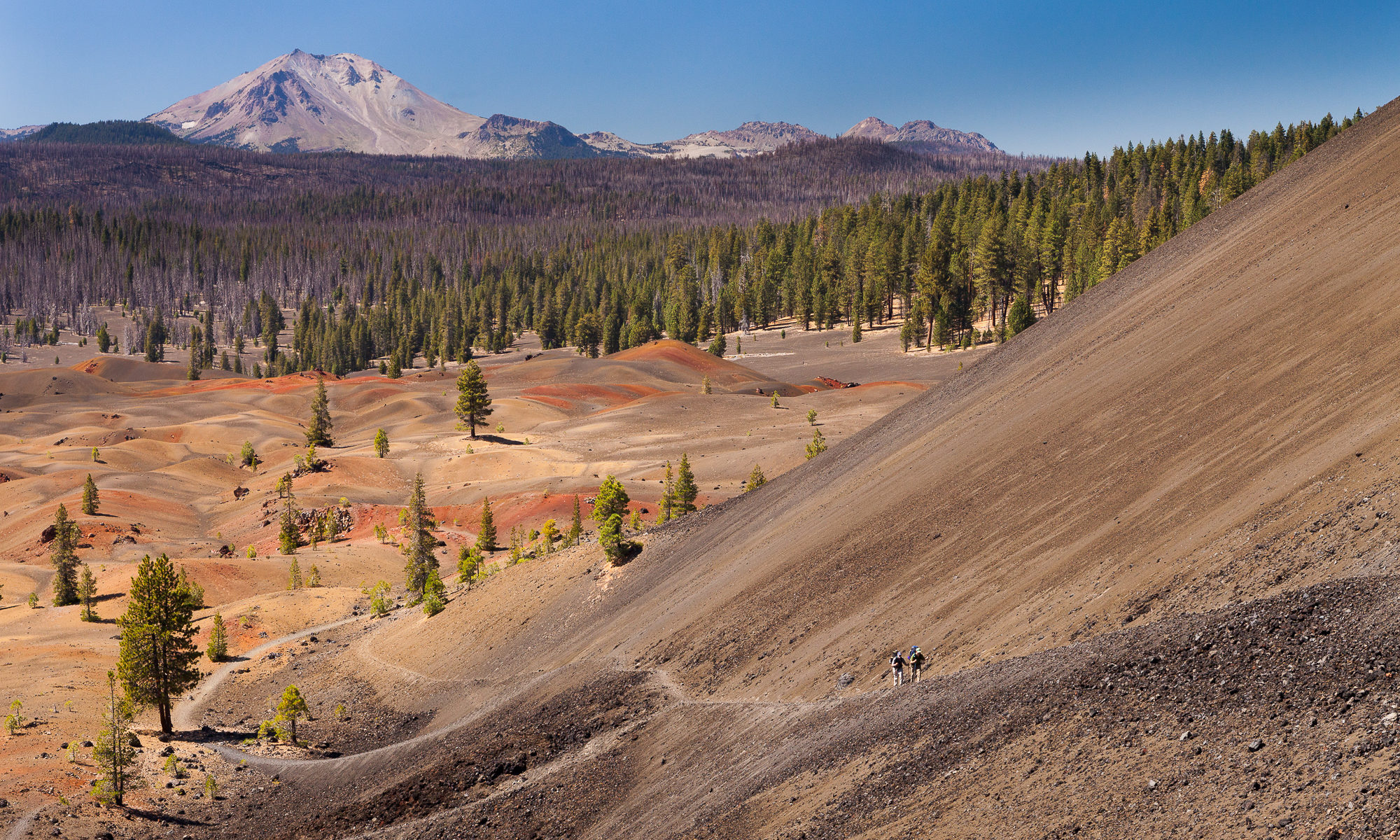
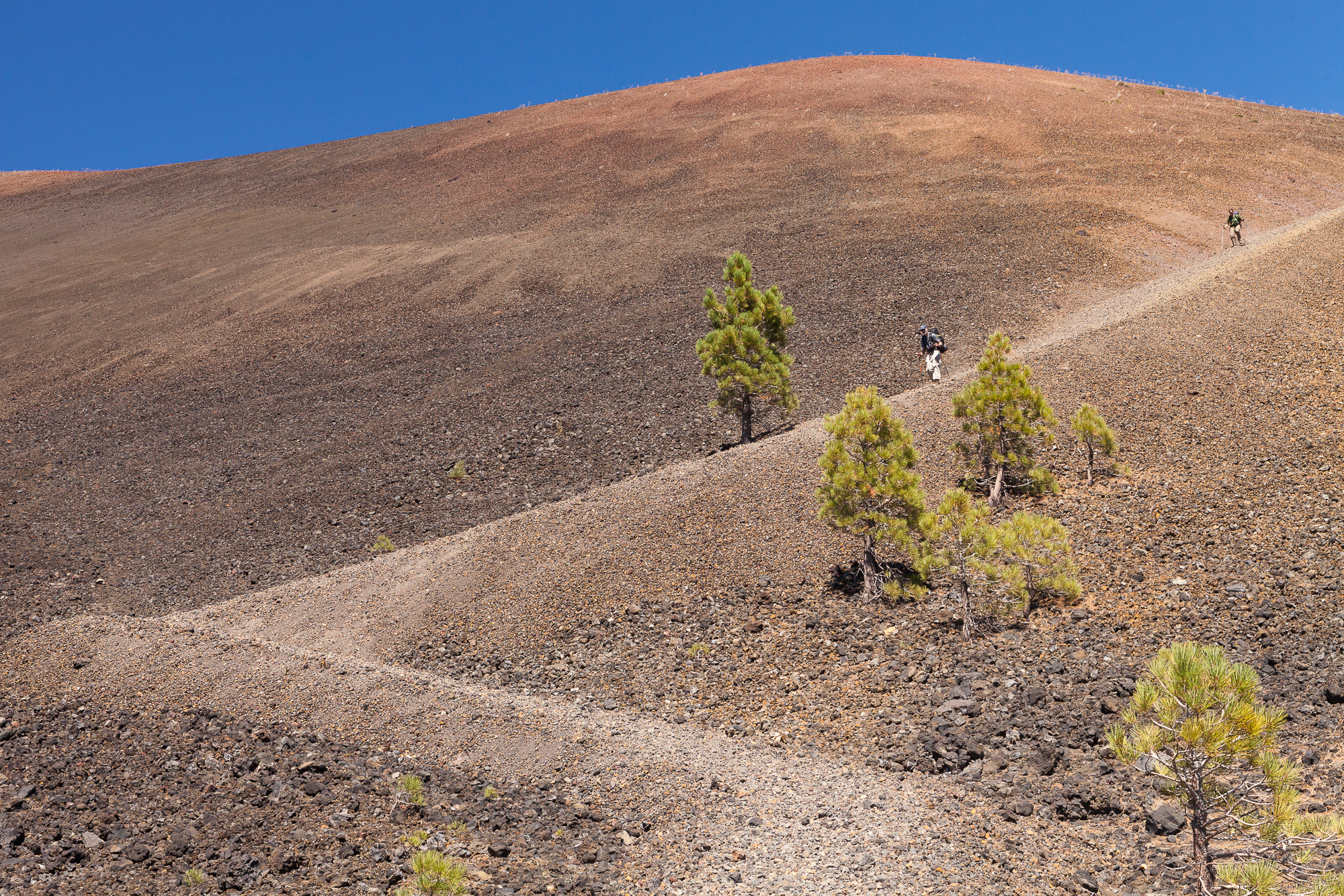
We spent the night at Snag Lake, and in the morning, approached the Cinder Cone from the south. From there, we reached the steeper of the two trails that wind to the top. In the photo above, you can see my brother as a small speck as we neared the cone from the west.

Two backpackers climb the steep southern trail up the Lassen Cinder Cone. Mt Lassen and the Painted Dunes can be seen to the west.

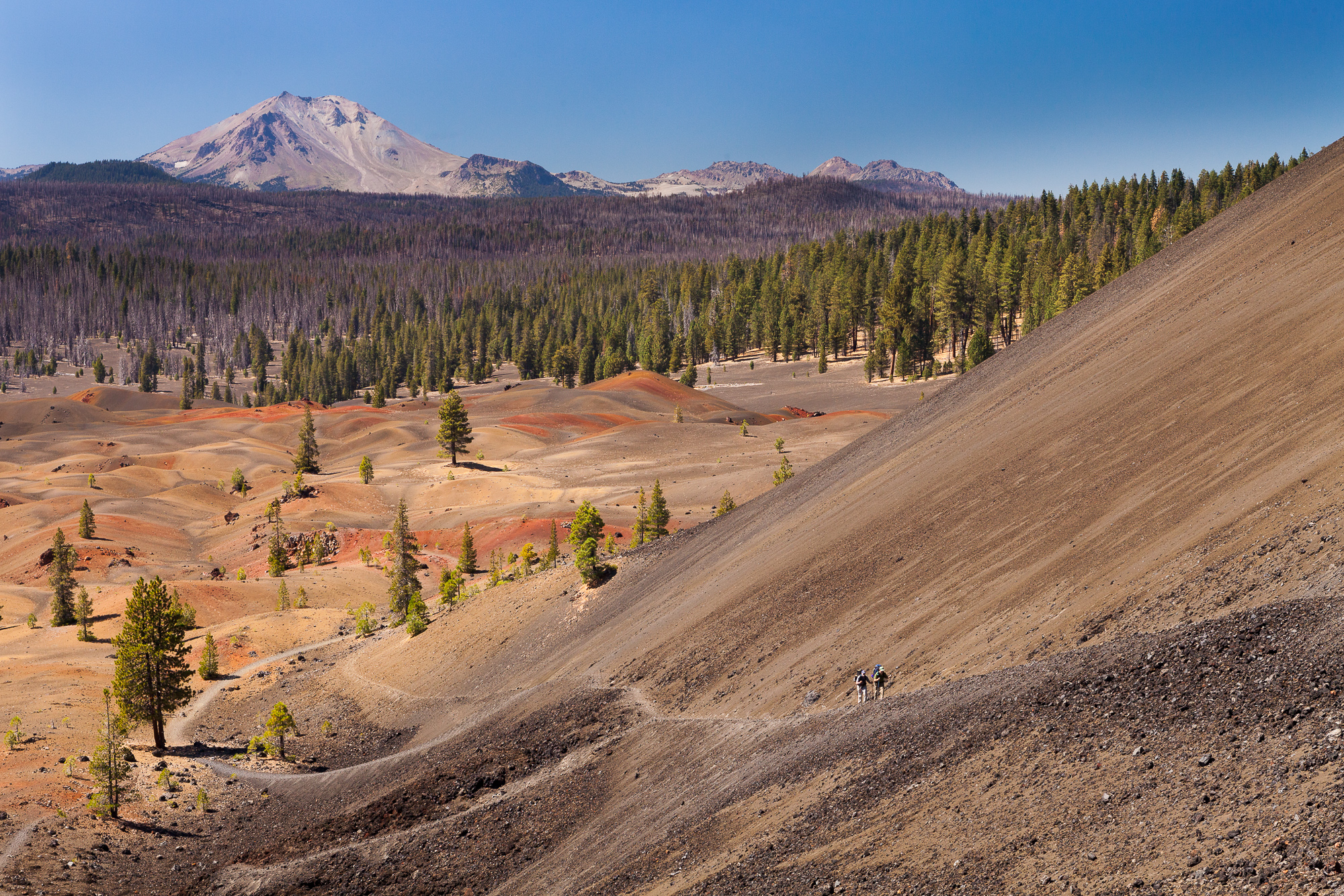
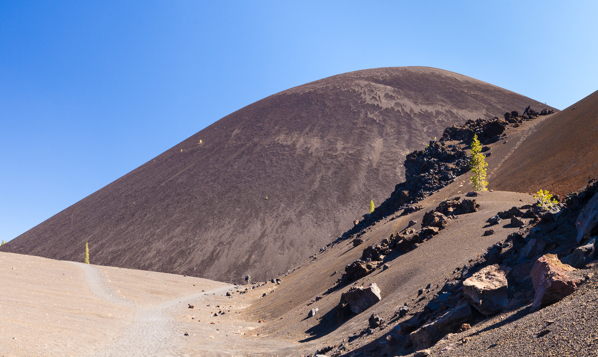
The trail to the top is built using the loose volcanic scoria that makes up the cone itself. It is only a little more solid than walking up a sand dune, and is not for the faint of heart. This is due not only to the phyisical exhaustion that comes from pushing up such a slope, but also the steepness of the trail itself. At times I felt like I was going to tumble backward down the trail as my backpack made me somewhat off balance.

A large cinder cone sits to the east of Mt. Lassen in Northern California. A trail decends a hundred feet into the mouth of the cinder cone to a large steam vent.

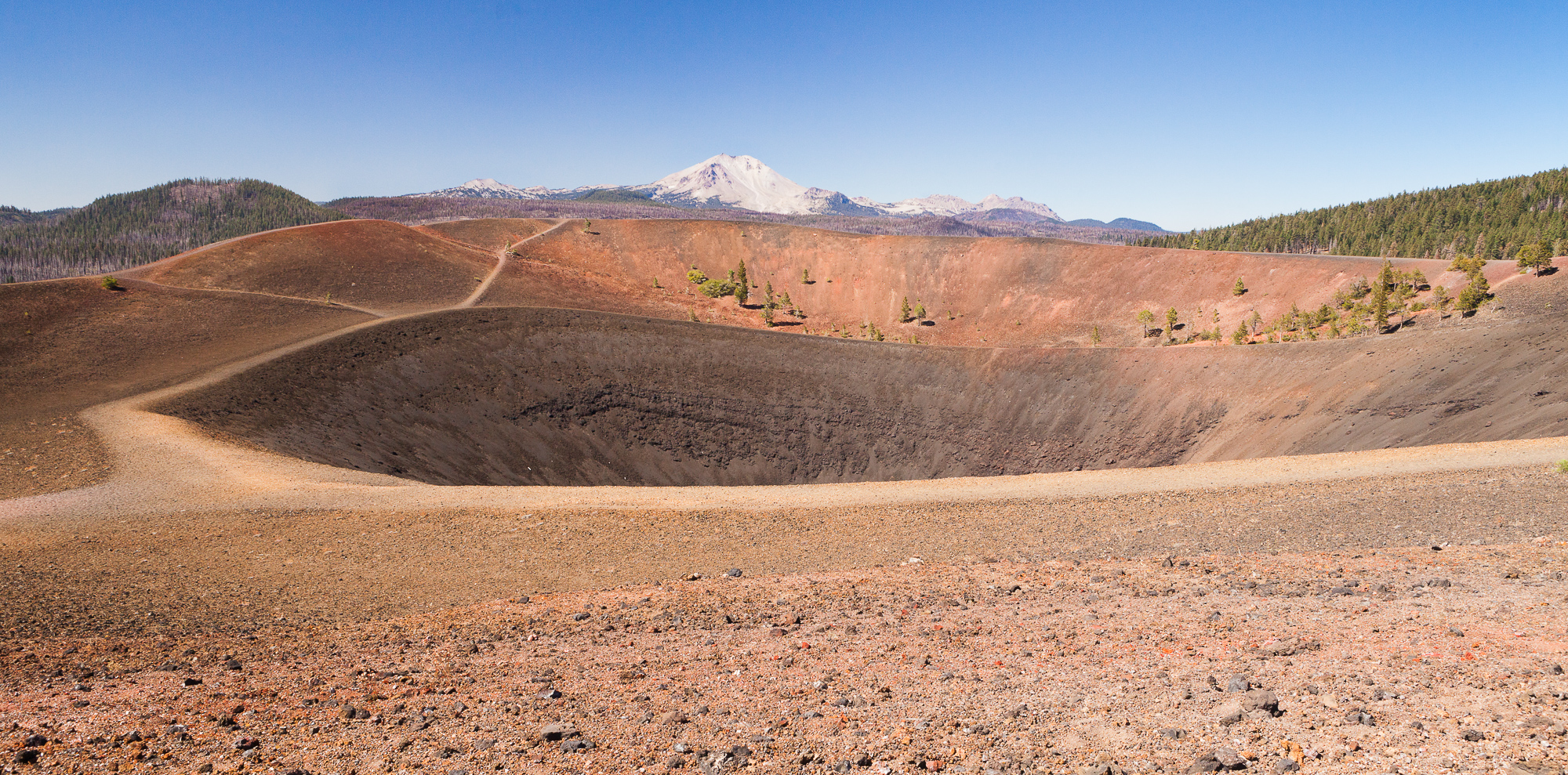
Those who reach the top are rewarded with spectacular views of Mt. Lassen to the west, as well as a chance to peer down into the crater of the cone. A trail even descends into the mouth of the crater, where you can stand next to thermal steam escaping from the ground.

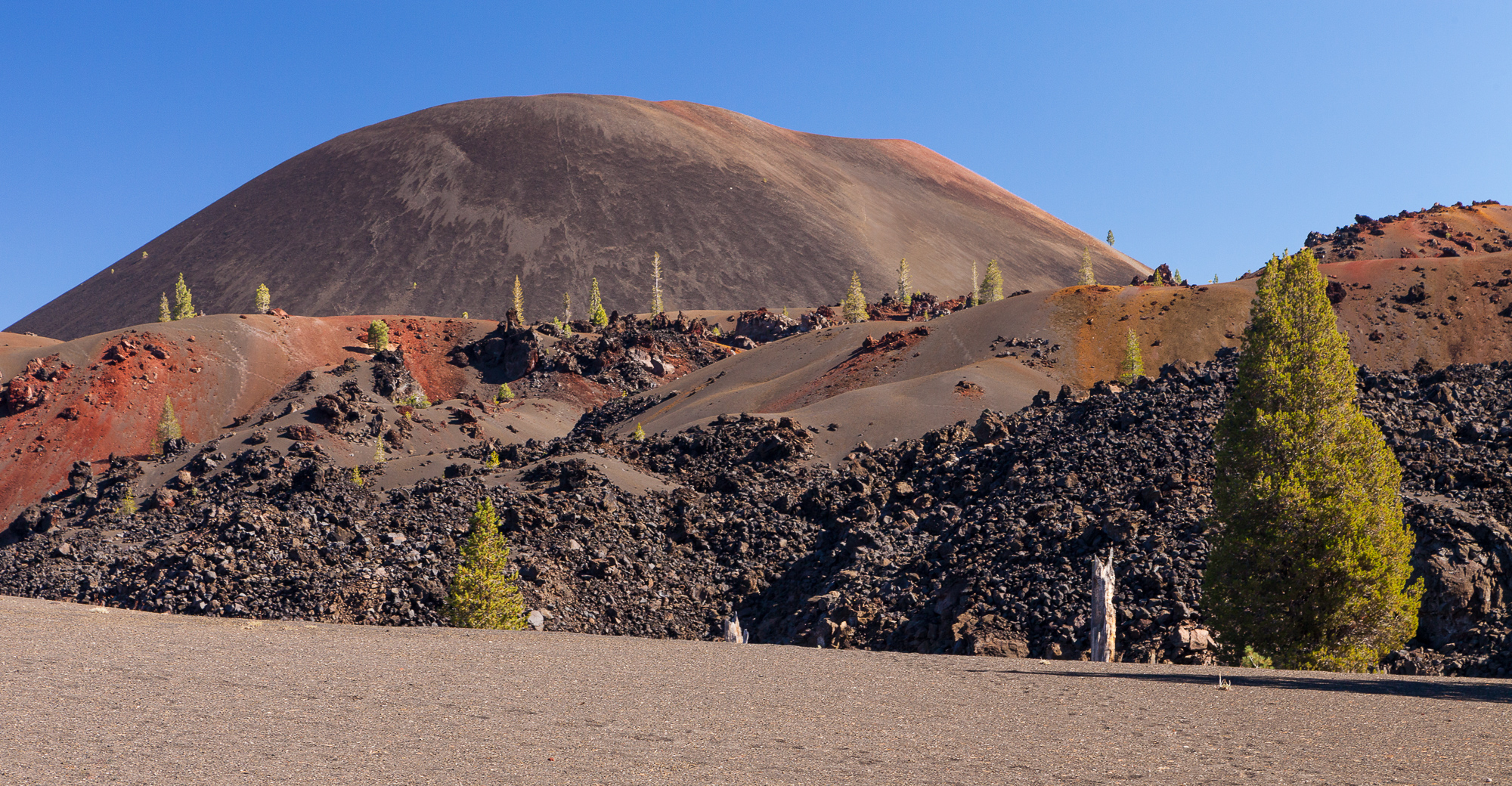
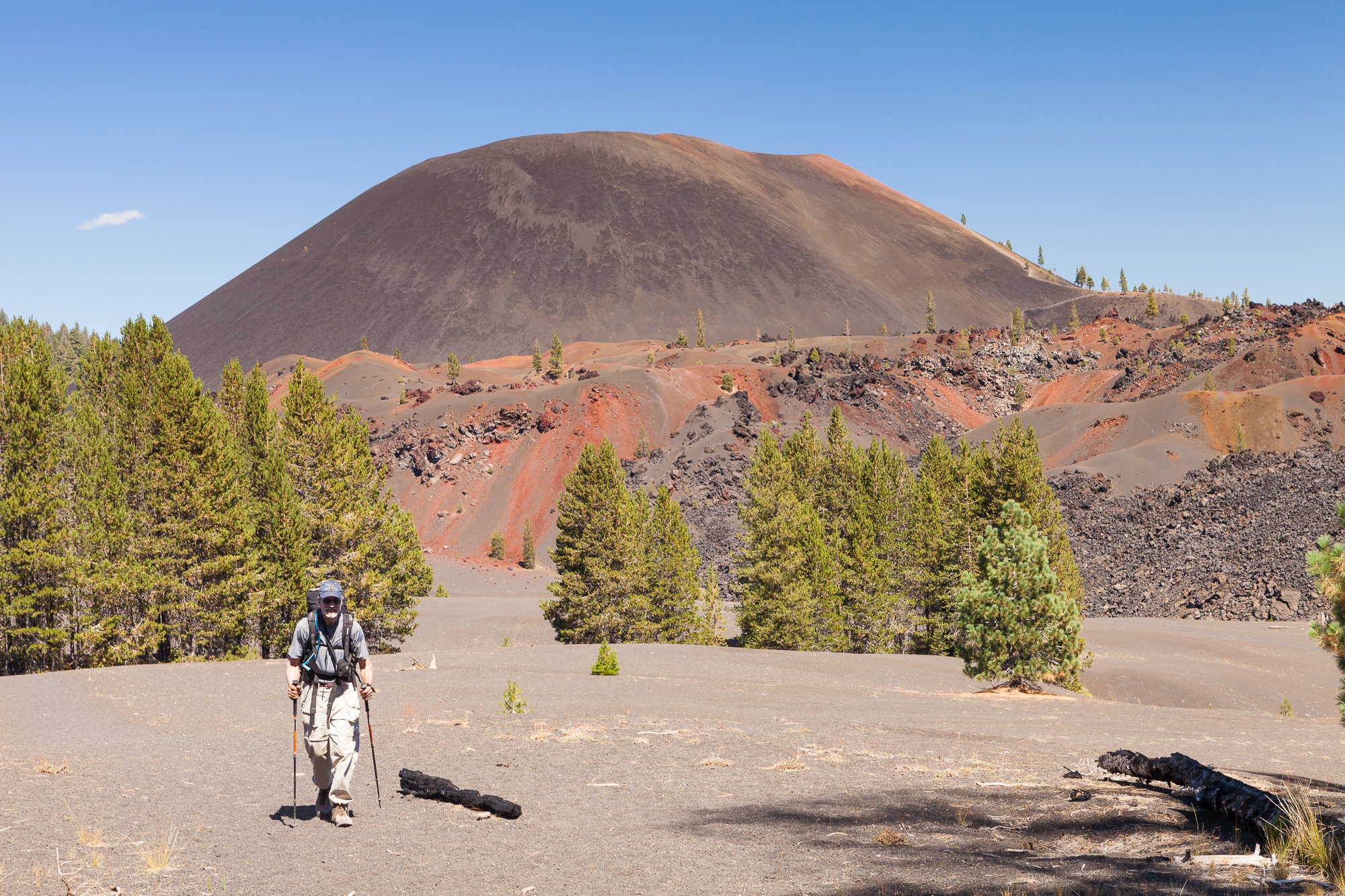
The cinder cone was formed long ago by many small eruptions that threw lava into the air, which cooled into the loose, porous volcanic rock. Over time, this piled up into the 700 foot tall cone that we see today. It is thought to have erupted as recently as the 1650s, though the only activity that remains today is the steam rising from the crater.

A backpacker looks at Mt. Lassen from the top of the Lassen Cinder Cone.

Walking to the western edge of the crater, we were rewarded with views directly across from Mt. Lassen, as well as views of the Painted Dunes below.

The Painted Dunes extend to the forest surrounding Mt. Lassen in Northern California. These volcanic dunes were formed by a thousand year old cinder cone.

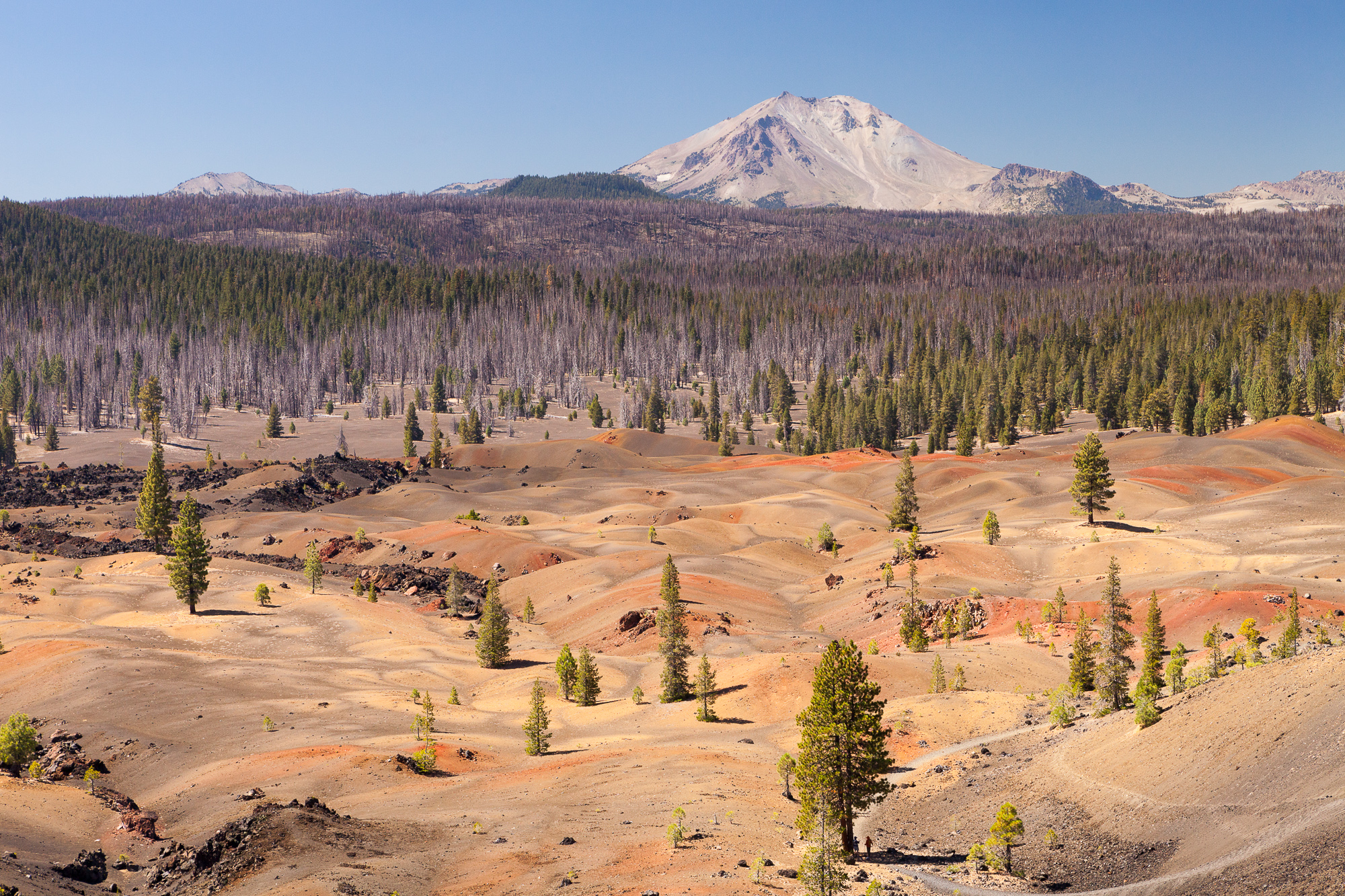
The painted dunes are pumice fields formed by oxidation of volcanic ash from earlier eruptions of the Cinder Cone. Its beautiful colors formed because the ash fell on lava that was still hot and forming.

Two backpackers decend the steep southern trail of the Lassen Cinder Cone, Mt Lassen National Park.

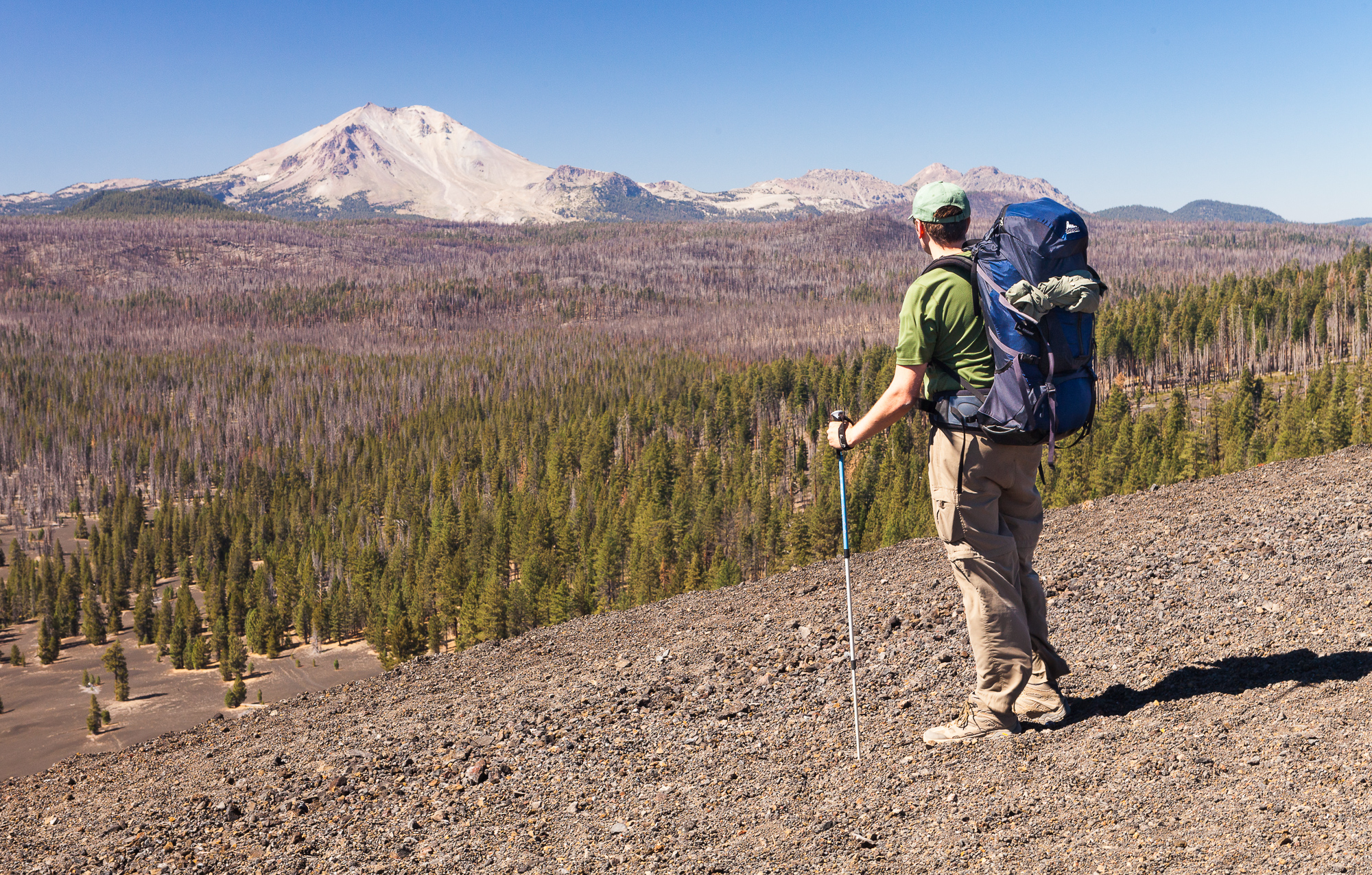
After a while at the top, and after we tired of braving the fierce wind, we descended the way we had come up. I tried not to think about the consequences of losing my footing, and took it step by step.

A backpacker heads west away from the Lassen Cinder Cone, Mt Lassen National Park.

Soon we were down and continuing our day’s hike to our destination of Summit Lake. The promise of camp chairs and cold beer quickened our step. It was great to spend time up close with this unusual creation of nature.

Burney Falls

Burney Falls drops across a wide cliff into a pool below, creating a tree-lined grotto.

Burney Falls is located in Northern California in McArthur-Burney Falls Memorial State Park. It is a beautifully wide waterfall, dropping 129 feet into a tree-lined grotto below. Even in the summer months, when most other creeks in the area have withered or dried up to nothing, this falls keeps up its steady flow rate. This is because the water originates from an underground spring not far upstream from the falls itself.

Burney Falls drops across a wide cliff into a pool below, creating a tree-lined grotto.

There are many ways to photograph the falls, from the grand view taken above the falls, to more intimate closeups of rivulets running over bright green moss. It is important to shoot waterfalls with a tripod – that way you can use longer exposures and blur the water into a glossy silk texture. Down in the grotto, it was dark enough to let the exposure run over a second, giving me the desired look.

Burney Falls drops across a wide cliff into a pool below, creating a tree-lined grotto.

One challenge was to balance bright hot spots of light reflecting off the water with the dark shadows within the rocks. Luckily a quick check of the histogram on the back of my camera told me that I was able to capture the entire dynamic range of the scene in a single shot, and so I exposed to the right, getting as bright an exposure as possible without blowing out the highlights. This was corrected in post processing, giving me an amazing amount of detail in the shadows.

I’d love to go back and shoot this scene in early, pre-dawn light, which would give me soft even lighting across the entire scene. The quick visit left me thinking of many other compositions I could use to better cover the variety seen in this beautiful falls.

2015 Round-up – Top 40 Photos Of The Year

The sun sets behind the western horizon, casting the offshore sea stacks into shadow, Bandon, Oregon

I recently finished compiling my top 40 picks from the last 12 months. The gallery is an assortment of my various trips and outings, including trips to India, Mexico and Canada. As always, there is a mixture of bird, wildlife and landscape, including some previously unpublished.

Please enjoy the gallery below. For best viewing (especially if viewing on a mobile device), please click on the following photo:

The sun sets behind the western horizon, casting the offshore sea stacks into shadow, Bandon, Oregon

To view the gallery, click here to see individual photos.


If you are interested in compilations from previous years, please see the 2010, 2011, 2012, 2013, and 2014 lists.

Recent Publication – Travel Oregon Top Fall Hikes

This image of Eagle Cap Wilderness in eastern Oregon was published by Travel Oregon in an  article about the hiking area.
This image of Eagle Cap Wilderness in eastern Oregon was published by Travel Oregon in an article about the hiking area.

This image of Eagle Cap Wilderness was used in a recent article on Oregon’s top fall hikes by Travel Oregon. You can find the full article by clicking through to their website. I took this photo five years ago on a fall backpacking trip with my brother and father. You can read about the epic trip here and of course see many more photos.

Copyright 2017 Hank Christensen